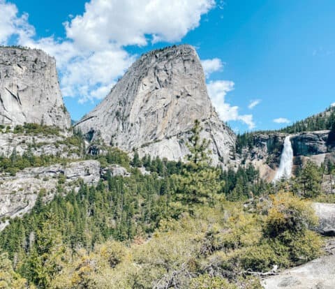
Great Smoky Mountains National Park is famous for its rolling mountains, lush waterfalls, and that classic “smoky” mountain haze. There are hundreds of miles of epic hiking trails, dozens of waterfalls, and miles of scenic drives. With so much to do, planning the perfect 2 days in the Smoky Mountains can feel pretty overwhelming.
While I usually prefer the dramatic western National Parks, after visiting the Smoky Mountains 3 times, I have to say the deep forests and endless rolling mountains of this park have definitely grown on me.
To help plan your ultimate trip, I put together this 2 day Great Smoky Mountains trip itinerary. This guide is perfect for first time visitors, and ensures that you don’t miss out on the highlights of the most visited National Park, even if you only have 1 weekend.
Disclosure: This post contains some affiliate links, which means if you buy something, my blog will receive a small commission at no extra cost to you. I will never recommend products or links on this blog that I have not personally used or fully endorse.
The Perfect 2 Day Great Smoky Mountains Itinerary
On Day 1 of your Great Smoky Mountains Itinerary, you’ll see:
- Alum Cave Trail
- Drive Newfound Gap Road
- Oconaluftee Visitor’s Center and Mountain Farm Museum
- Optional: Andrews Bald
- Clingmans Dome
On Day 2 of your Great Smoky Mountains Itinerary, you’ll see:
- Cades Cove Loop Road
- Laurel Falls

The Great Smoky Mountains is Indigenous Land
The Smokies are ancestral lands of the Cherokee people, who called the place Shaconage or “place of blue smoke.” Most Cherokee Indians peoples were forcibly removed from the area in the 1800s during the march known as the “Trail of Tears.” Learn more about the Cherokee history in the Smokies here.
This itinerary assumes you have 2 full days to spend inside the Park, and are staying on the Tennessee side.
Staying in North Carolina? If you are visiting from or staying in North Carolina, you will want to do the Day 1 itinerary in reverse, visiting the Oconaluftee Visitor’s Center first, before driving Newfound Gap Road west towards the Sugarlands Visitor’s Center.
2 Day Itinerary Smoky Mountains Map
This map shows all your stops on your 2 day Great Smoky Mountains itinerary.
How to Use This Map: Click the Icons on the map to see more information about each location. Click the star at the top of the map to add the map to your Google Maps account.
Want to take this itinerary to go? The 3 Day and 2 Day Great Smoky Mountains Itineraries include over 20 pages of daily itineraries, an in-depth Cades Cove guide, a detailed guide to the best hikes in Great Smoky Mountains, plus lodging and dining information, and tips for how to beat the crowds! Get your guide and learn more, here.

Great Smoky Mountains Itinerary Day 1
Your first day of your Great Smoky Mountains weekend is all about those iconic Smokies views. To maximize your time and avoid crowds, start as early as possible, ideally before 8am. Pack a lunch and enjoy a picnic on the go, or visit the many restaurants in Gatlinburg to relax before returning to the Park for must-see sunset.
If you only have one day in Great Smoky Mountains, this is also the perfect itinerary to visit the must-see areas of the park on limited time.
Hike Alum Cave Trail
Start your first day early in the Great Smoky Mountains with one of the most iconic hikes in the Park. The Alum Cave Trail ascends through forest and rocky cliffs to the summit of Mt LeConte.
- Distance: 5 miles round trip to Alum Cave Bluffs / Moderate
- Distance: 10.9 miles round trip to Mt LeConte / Strenuous
- All Trails
Need a map? Don’t forget to download your map and save it to your phone or GPS device before your hike! Get AllTrails Plus or AllTrails Peak (the most used trail app on my phone!) to download all your trail maps for offline use. Use my promo code brookeinboots30 to get 30% off your annual AllTrails subscription!
The Trailhead is located on Newfound Gap Road, about 9 miles from the Sugarlands Visitor Center. Parking is really limited here and the spots fill up quickly, so try and get here as early as possible (before 8am).
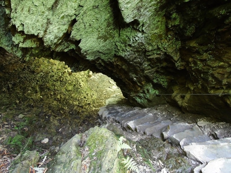
The trail begins by following the Alum Cave creek through hardwood forest. Next, at 1.5 miles, hikers traverse through “Arch Rock” tunnel before ascending to Inspiration Point at 2 miles.
Most hikers turn around at Alum Cave Bluffs, about 2.3 miles from the trailhead.
Looking for more of a challenge? Continue on Alum Cave Bluffs to ascend 6,575′ Mt LeConte. LeConte Lodge is located at the peak, the only hotel-style lodging located inside the Park. The Park uses llama trains to pack up supplies (and pack out trash) from the Lodge. If you’re lucky you might spot them on their weekly trek!

We weren’t lucky enough to see llamas on our trip, but fingers crossed we catch them next time!
Optional: Stop by the Sugarlands Visitor’s Center
After your hike, you can backtrack slightly to stop at the Sugarlands Visitor Center.
I’ll admit, this stop is never optional in my book, mostly because I’m a huge museum geek, and need to get my Passport stamp. The Visitor Center is also an important stop to collect maps and ask advice from Park Rangers about trail conditions, parking availability, weather, and any other important information you’ll need before heading out.
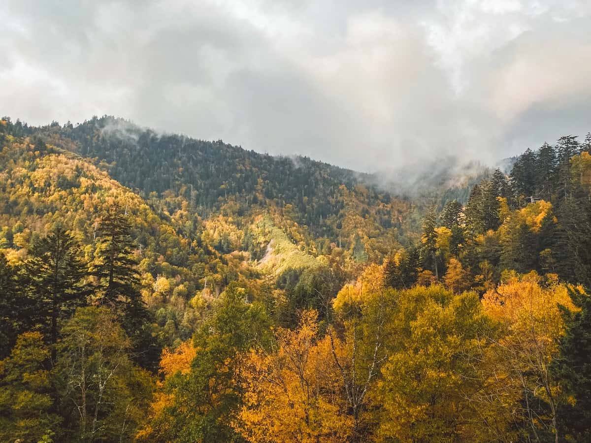
Drive Newfound Gap Road
Once you have your maps, stickers, and stamps from the Visitor’s Center, return to US 441 South, known as Newfound Gap Road.
This highway runs through the heart of Park from Tennessee to the town of Cherokee, North Carolina.The road ascends nearly 3,000 feet in elevation to Newfound Gap (5,046′).
After hiking, this is my favorite thing to do in the Smokies. The views are stunning, especially as you approach Newfound Gap. If you’re visiting in fall, the colorful leaves along this drive are simply incredible.
Must see stops along Newfound Gap Road include:
- Campbell Overlook
- Chimney Tops Overlook
- Morton Overlook (Beautiful at any time of day, Morton Overlook is a popular spot for sunset.)
- Newfound Gap
- Mingus Mill

Once you reach Newfound Gap, you’ll cross the state line between Tennessee and North Carolina.
Note the turnoff for Clingmans Dome Road here. You’ll be coming back this way for the hike to Andrews Bald and Clingmans Dome for sunset.
If you don’t have time to drive all the way to Oconaluftee, Newfound Gap makes a good spot to turn around, or head straight for Clingmans Dome parking.
If you have time, you can continue south on Newfound Gap Road towards Mingus Mill and the Oconaluftee Visitor Center.
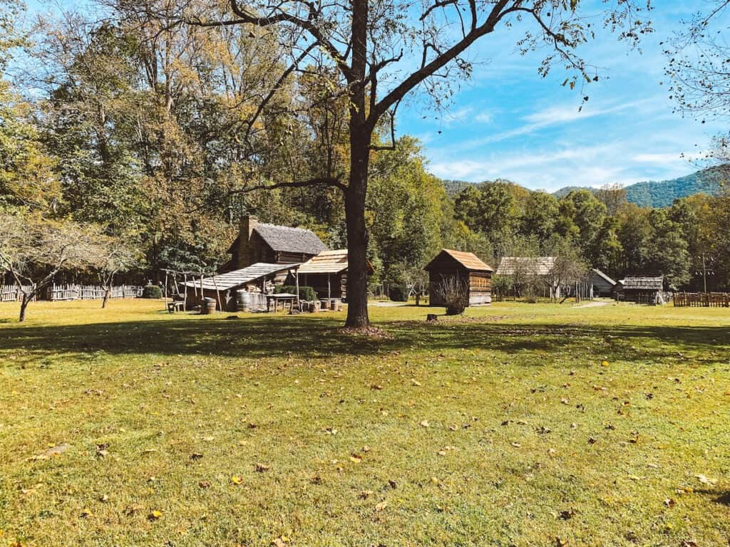
Oconaluftee Visitor Center & Mountain Farm Museum
At the southern end of Newfound Gap Road lies the Oconaluftee Visitor’s Center and the town of Cherokee, North Carolina. The Oconaluftee Center includes exhibits about the Cherokee and later European settlers who have made the region home for hundreds of years.
The Mountain Farm Museum next to the visitor center is a huge interactive museum of preserved pioneer farm structures, including farmhouse, barn, and working blacksmith shop. Look closely and you can see the chickens that still call this farm home.
Keep your eye’s open for the herds of Elk that make this area home, especially in Fall.
Hike to Andrew’s Bald
- Distance: 3.6 Miles
- Difficult: Moderate / 875 feet elevation gain
- AllTrails
After stretching your legs inside the Visitor Center, return to your car and head north on Newfound Gap Road, retracing your route to Clingmans Dome Road, across the highway from the Newfound Gap Overlook you visited earlier.
The road climbs and ends at the Clingmans Dome parking lot. Warning, parking here can be a bit of nightmare during the summer. Be patient, and try and visit later in the afternoon, after 4pm, when many visitors start to leave the Park for the day.
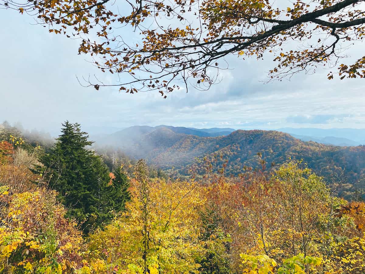
If you have the time, Andrews Bald is the perfect companion to a sunset on Clingmans Dome. The 3.6 moderately difficult hike leads to one of the many “balds” in the Smokies, so called because these mountaintops are not covered by trees, but grass, rhododendron, and laurel.
From the Clingmans Dome parking lot, set out on the paved road towards Clingmans Dome. Shortly after the Park’s large interpretive signs, less than 0.1 miles from the parking lot, you will see a small trail and sign and on your left for “Forney Ridge Trail” to Andrews Bald.
Follow the Forney Ridge Trail as it descends for the first 1.1 miles through forest. Continue to follow signs for Andrews Bald at all trail junctions. The trail then heads uphill to Andrews Bald, with panoramic views of the surrounding mountains. The trail continues past the Bald, but turn around after you’ve soaked in the view and return the way you came, following signs for Clingmans Dome parking.

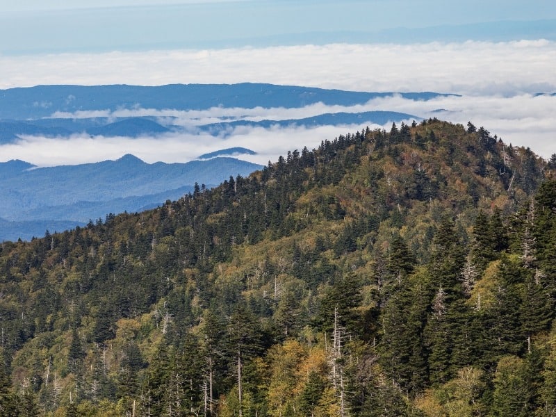
Sunset at Clingmans Dome
At 6,643 feet, Clingmans Dome is the highest point in the Smoky Mountains. The Appalachian Trail crosses at the base of the observation tower, and this spot is actually thehighest point on the AT.
At the summit of the Dome, the 45 foot high Clingman’s Dome Observation Tower provides 360 degree views of the surrounding mountains.
- Distance: 1 Mile
- Difficulty: Moderate / Not Wheelchair Accessible Due to Steep Grade
- AllTrails Trail Map
I will warn, this area is often cloudy and storm, even in summer, meaning you aren’t guaranteed views. I suggested you check weather conditions at the Dome before committing to your hike. Arrive early and expect big crowds at the Observation Tower.

Want to take this itinerary to go? The 3 Day and 2 Day Great Smoky Mountains Itineraries include over 20 pages of daily itineraries, an in-depth Cades Cove guide, a detailed guide to the best hikes in Great Smoky Mountains, plus lodging and dining information, and tips for how to beat the crowds! Get your guide and learn more, here.
Great Smoky Mountains Itinerary Day 2: Cades Cove & Laurel Falls
Day 2 of your 2 day itinerary in the Smoky Mountains is the perfect opportunity to explore more of the Park’s scenic drives and historic structures.
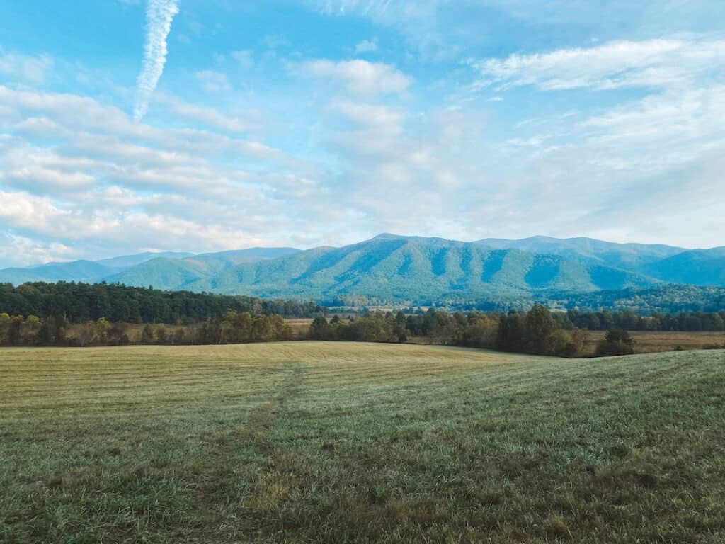
Cades Cove Loop Road Scenic Drive
Cades Cove is a broad valley surrounded by Smoky Mountains on all sides. The Cades Cove Loop Road is an 11 mile scenic tour of the many historic structures and sights of the Cove, and one of the most popular spots in Great Smoky Mountains Park.
Cades Cove Loop Road is vehicle free, every Wednesday, May 5 through September 1. During these times, the loop is only open to hikers and bicycles to enjoy.
The Cades Cove Loop road is an 11 mile scenic drive through the broad Cades Cove valley. The area was first settled by Europeans in the early 1800s, and many historic structures have been preserved here from this era.
While driving the Loop Road theoretically can take less than an hour, its really an all-day event. Plan to get out of your car and explore the historic buildings and enjoy a short hike or two.
Some of the must-see stops in Cades Cove are:
- John Oliver Cabin
- Primitive Baptist Church, Methodist Church, and Missionary Baptist Church
- Elijah Oliver Place
- Cades Cove Visitor Center and Historic Grist Mill
- Abrams Falls
- Whitehead Cabin
- Dan Lawson Place
- Tipton Oliver House
- Carter Shields Cabin
Check out more things to do in Cades Cove, including detailed descriptions of all these stops here.
The Visitor Center, located about halfway around the loop is a good spot to stretch your legs and enjoy a picnic.
The Historic Grist Mill next door is a working water-powered mill that still operates to this day! You can learn all about farming history in this super remote valley, and take home a bag of mill-ground cornmeal from the giftshop!
There are plenty of homesteads and cabins around the loop, but our favorite was the Whitehead Cabin, located off the main road on Forge Creek Road, just past the visitor center. Since this spot isn’t on the main Cades Cove Loop road, its not as crowded and you might actually get a moment to yourself!

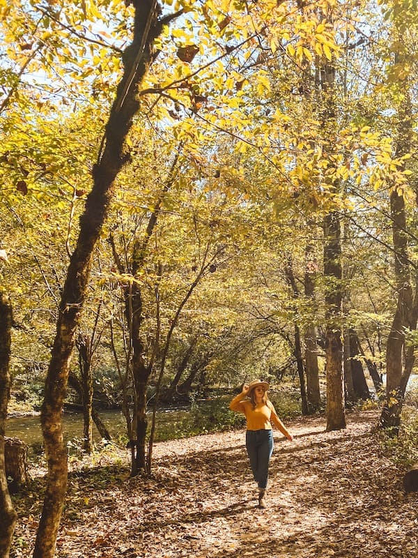
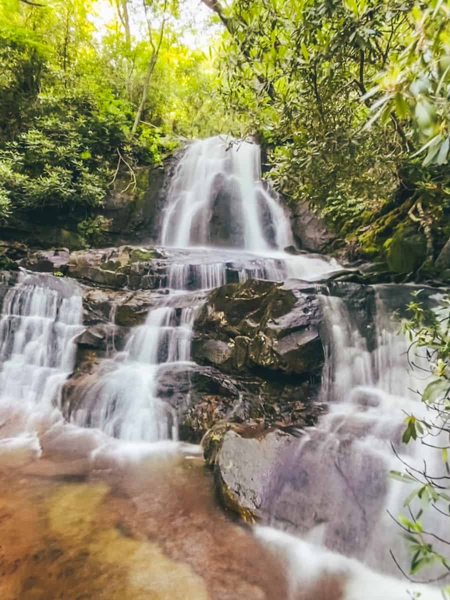
Hike to Laurel Falls
From Cades Cove, head back in the direction of the Sugarlands Visitor’s Center and Gatlinburg. About 40 minutes from Cades Cove, you’ll find the designated parking lot for your next stop, Laurel Falls.
This is one of the most popular things to do in the Smoky Mountains and a nice family-friendly waterfall hike.
The parking lot is frequently full during summers and weekends. Overflow parking lots are located further down Fighting Creek road. Park and walk to the trailhead, following the signs.
- Distance: 2.4 Miles
- Difficulty: Easy / Not wheelchair or stroller accessible
- AllTrails
From the Laurel Falls trailhead, the trail climbs gently through the forest before arriving at the falls. Keep your eyes open for black bears, especially early in the morning, as there have been lots of sightings on this trail.
Dinner in Gatlinburg
Grab dinner in Gatlinburg after a busy 2 days in Great Smoky Mountains. Our favorite restaurant was The Park Grill in Gatlinburg. For a more upscale option, check out The Appalachian in nearby Sevierville. For pizza and brews, check out Gatlinburg Brewing Company.

More Things to Do in Great Smoky Mountains National Park
Have more than 2 Days in the Park? Want to try something different? Check out these other things to do in Great Smoky Mountains National Park.
Roaring Fork Motor Nature Trail
Located a short distance from Gatlinburg, the Roaring Fork Motor Nature trail is a 5.5 winding, scenic drive through hardwood forests and historic cabins and grist mills, and a shorter, less-crowded alternative to Cades Cove. Check out the hikes to Rainbow Falls (5 Miles / Moderate) and Grotto Falls via Trillium Gap Trail (2.6 Miles / Moderate).
Hike Charlies Bunion via Appalachian Trail
Hike the Appalachian Trail on this moderate, 8-mile hike that traverses multiple peaks on its way to Charlie’s Bunion, a large outcropping with classic smoky mountain views. The Trail leaves from Newfound Gap where the Appalachian Trail crosses with Newfound Gap Road.
This hike takes about 4 hours round trip. Make sure to bring plenty of water, snacks, and appropriate hiking gear.
Hike or Backpack Gregory Bald
Gregory Bald is a strenuous day hike that is also popular for backpacking. After a steady climb of 3,400′ over 5.5 miles, the summit of Gregroy Bald has stunning views of the surrounding Smokies and Cades Cove.
How to Get to Great Smoky Mountains National Park
There are no shuttles around Great Smoky Mountains, so you’ll want to fly into one of the closest airports to the Great Smoky Mountains, rent a car, and drive to the Park.
The nearest airport to Gatlinburg, Tennessee (Sugarlands Entrance) is Knoxville McGhee Tyson Airport. The nearest airport to Cherokee, North Carolina (Oconaluftee Entrance) is Asheville Regional Airport, in Asheville, North Carolina.
The nearest international airport to Great Smoky Mountains is Greenville-Spartanburg International Airport in Greenville, South Carolina.
Does Great Smoky Mountains charge an Entrance Fee?
There is no entrance fee to visit Great Smoky Mountains National Park.
But, you DO have to pay for parking, starting in 2023. Beginning March 1, 2023 Great Smoky Mountains National Park will require all visitors to purchase and display a “Parking Tag” while parking inside the National Park for more than 15 minutes. One Parking Tag is required per vehicle.
Parking Tag fees are $5 per day, $15 per week, and $40 annually.
Parking Tag sales are not limited or capped, meaning you do not need advanced reservations to enter the Park. Parking tags do NOT guarantee a parking spot, so be sure to arrive early to trailheads and popular spots!

Is Great Smoky Mountains Dog Friendly?
Pets are allowed in campgrounds and picnic areas, and along 2 short walking paths – the Gatlinburg Trail and Oconaluftee River Trail. Pets are also allowed anywhere your vehicle can go, such as roadside pull-offs and sidewalks.
Pets are not allowed on other trails and must be leashed at all times.
Where to Stay Near Great Smoky Mountains National Park
There are plenty of options for lodging in and around Great Smoky Mountains National Park. Stay in one of the popular 10 frontcountry campgrounds inside the National Park, or opt for hotels, motels, and rental cabin accommodations in the towns nearby.
There is only one hotel inside the park, Le Conte Lodge, which is only accessible on foot via a 5.5 mile hike. Reservations for Le Conte fill many months in advance, but cancellations do occur if your plans are flexible.
If you only have two days or less to visit Great Smoky Mountains, I recommend staying in the towns of Pigeon Forge or Gatlinburg on the Tennessee side of the Park. These towns are located just outside the Sugarlands entrance and Visitor Center, and most hotels are within 20 minutes of the park.
There are a variety of chain hotels like Fairfield Inn & Suites by Marriott and family-friendly mountain resorts like the Greystone Lodge on the River. Personally, we love to book a vacation home rental with a kitchen – and there are tons of cabins and mountain homes to book nearby.

Explore More in the Great Smoky Mountains
Ultimate 2 Day Great Smoky Mountains Itinerary
Explore More in the Great Smoky Mountains
Ultimate 2 Day Great Smoky Mountains Itinerary