
Joshua Tree National Park is a hiker’s paradise. From easy walks that take you through sprawling cacti fields to treks that offer breathtaking panoramic views, there’s a hiking trail for everyone in this otherworldly National Park. I’ve been lucky enough to explore Joshua Tree National Park on multiple trips, and let me tell you, it never fails to impress. This guide includes a list of the 17 of the best hikes in Joshua Tree National Park. So lace up those boots, it’s time for a hike in Joshua Tree National Park.
Disclosure: This page may contain sponsored content or affiliate links, including Amazon links, where I earn a small commission from any purchase – at no extra cost to you. This commission helps keep Brooke In Boots up and running. As always, all opinions are 100% honest and my own!
A Quick Look at the Best Hikes in Joshua Tree National Park
Wondering what are my favorite hikes from this list? Every hike on this list brings something unique to the table, but these are my can’t miss hikes for a first time visit to Joshua Tree National Park:
Most Beautiful Hike in Joshua Tree: Hidden Valley Nature Trail
Best Easy Hike in Joshua Tree: Arch Rock & Heart Rock
Best Moderate Hike in Joshua Tree: Ryan Mountain
Best Strenuous Hike in Joshua Tree: Boy Scout Trail
Best Hike for Families: Discovery Trail
Want to learn More about visiting Joshua Tree National Park? Check out these Joshua Tree blog posts for suggestions on how to plan the perfect trip to Joshua Tree:
Check Out These Posts for More Free Resources on Visiting Joshua Tree
An Unforgettable Joshua Tree National Park Weekend: 2 & 3 Day Epic Itineraries
Closest Airports to Joshua Tree National Park & How to Get There
The Perfect Joshua Tree One Day Itinerary
Hiking Joshua Tree: 17 Memorable Hikes in Joshua Tree National Park
Important Tips for Hiking in Joshua Tree National Park
Before we dive into the list of the best hikes in Joshua Tree, here are some essential tips to keep in mind when hiking in Joshua Tree National Park:
- Hike Early: Even in winter, the desert sun is relentless, and there is little or no shade on most hikes in Joshua Tree. Try and start any long hikes before 9AM or earlier and plan to finish before the midday heat.
- Bring Plenty of Water: Carry at least 1 liter of water for every hour you plan on hiking. Stay hydrated and don’t forget to drink electrolytes and salty snacks. Always bring more water than you anticipate needing.
- Bring a Map and GPS: Always carry a map or GPS device, and download your trail info before you head into the Park. DO NOT rely on cell phone service in Joshua Tree, trust me, you won’t have any out there!
Want to learn more about planning an epic National Parks trip? Grab my free Ultimate National Parks Planning Guide, including 70+ pages of National Park packing checklists, planning tips, and everything you need to know to start planning a trip to all 63 National Parks!
What to Wear for a Hike in Joshua Tree National Park
The desert can be unpredictable, so it’s essential to dress appropriately for your hike. Here are some of my go-to clothing and gear recommendations for a comfortable and safe hike in Joshua Tree National Park:
- Sturdy Hiking Boots: A good pair of hiking boots will protect your feet from sharp rocks, cacti spines, and let you scramble around Joshua Tree’s boulders. I love my Merrell Moab Hiking Shoes or my Brooks Cascadia Trail Runners.
- Layers: The temperature can fluctuate greatly in the desert, so wear layers that can be easily removed or added as needed.
- Sun Protection: Bring a wide-brimmed hat, sunglasses, and tons of sunscreen to protect yourself from the intense desert sun.
- Gaiters: If you plan on doing any backpacking or long hikes in Joshua Tree, you might want to consider a pair of hiking gaiters (I LOVE these ones from Dirty Girl Gaiters) to keep sand and small rocks out of your hiking shoes.
Learn more about dressing for a day hike and more hiking tips, here.

What to Bring on a Hike in Joshua Tree
- Water : I know, I keep saying to bring water, but seriously bring enough water. There are no water sources on these trails, so make sure to arrive in the Park with all the water you’ll need for the day!
- Hiking Poles: Hiking poles aren’t necessary for most hikes on this list, but they can provide additional stability on uneven terrain and steep inclines, like Ryan Mountain.
- First-Aid Kit: Always carry a small first-aid kit in case of any emergencies.
- Snacks: Pack high-energy and nutrient-dense snacks to keep your energy levels up during the hike. Salty snacks and electrolytes can help you retain water and are critical to staying hydrated in the desert.
- Backpack: A sturdy backpack is necessary to carry all your essentials comfortably. Check out my favorite day-hiking backpacks, here.
Traveling to more than 2 National Parks or National Forests this year? Purchase an America the Beautiful National Parks Pass for $80, which covers entrance fees at all National Parks and NPS managed sites.
Learn more about what to bring on your next day hike in my in-depth guide, here.
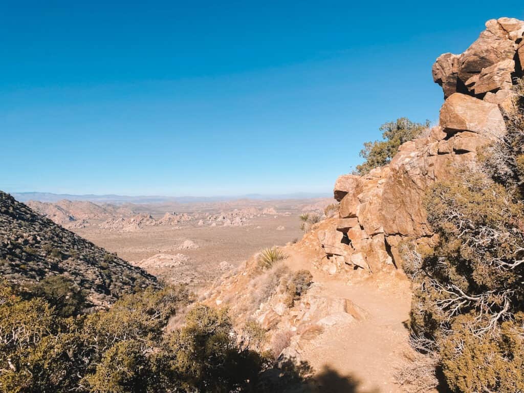
1. Hidden Valley Nature Trail
Distance: 1 Mile

Difficulty: Easy
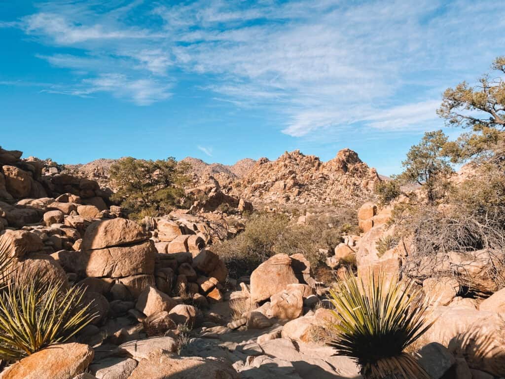
This easy, family-friendly loop trail circles a small valley that hides a unique desert ecosystem, and colorful history. Whenever I bring someone to Joshua Tree for the first time, I always make sure we hit the Hidden Valley Nature Trail – its got a little bit of everything that makes Joshua Tree so unique.
Legend has it that 1800’s cattle rustlers and bandits used the natural protection of the valley to hide their stolen herds.
Today, the Hidden Valley Trail is dotted with interpretive signs explaining about the Valley’s unique ecosystem. The rocks that ring the valley block wind and trap moisture, creating a microclimate.
The Valley is home to Piñon pine, juniper, yucca, Joshua Trees, and other desert plants.
Despite being one of the most popular hikes in the Park, the turn-off for Hidden Valley Trail can be a little hard to find. From Park Boulevard, follow signs for the Hidden Valley Picnic Area. The trailhead starts at the restrooms on the right hand side of the parking area.
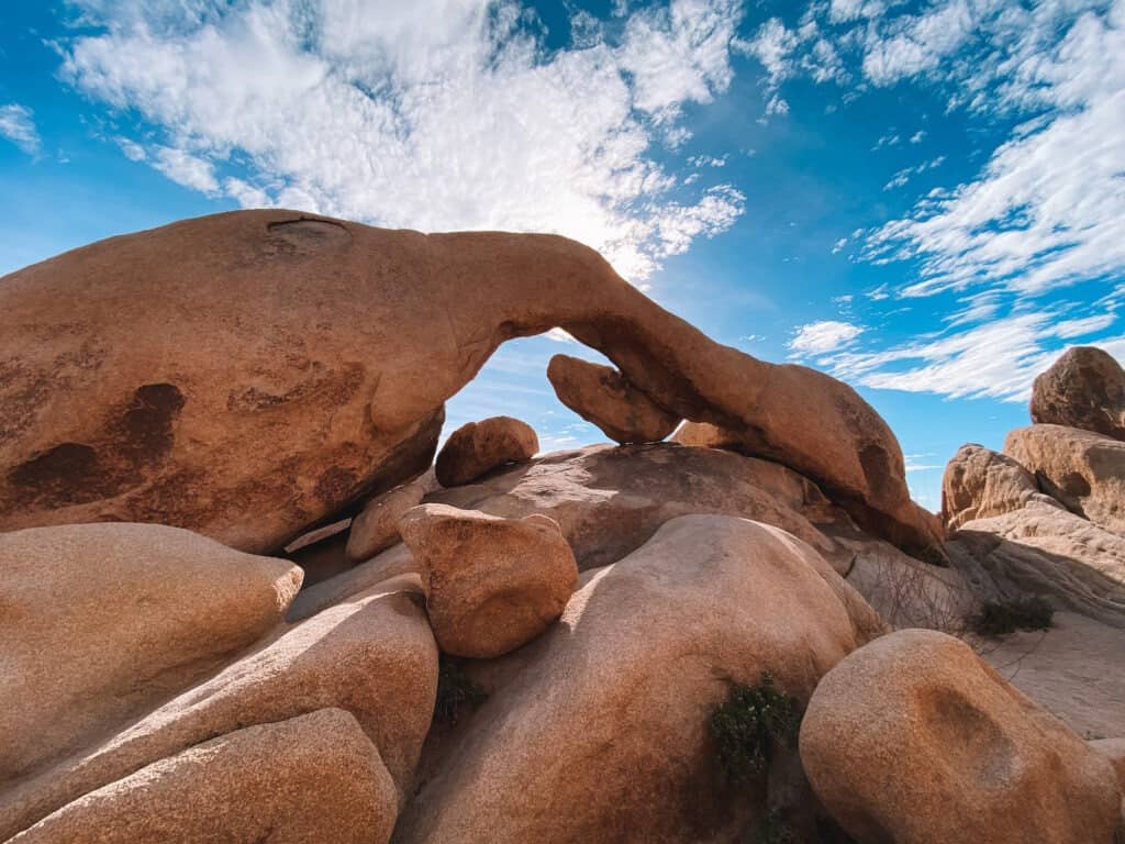
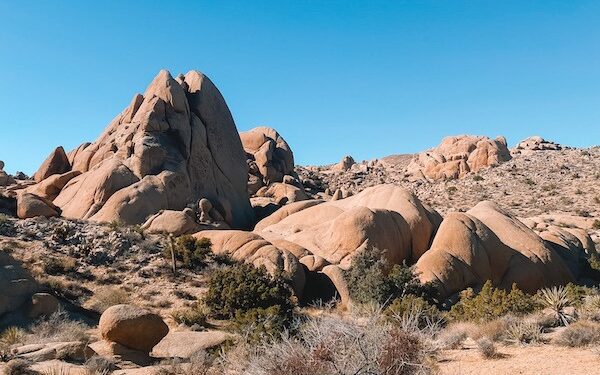
3. Arch Rock
Distance: 1.2 Miles Out and Back
Difficulty: Easy
Arch Rock is a must-see and one of the most popular stops in Joshua Tree National Park. This easy trail, accessible even to first-timers, is like stepping into another world.
The trail begins at the well-marked Arch Rock parking lot. Carefully cross the street, then follow the signs to the Arch Rock Nature Trail.
The trail winds through a fantastical maze of boulders and Joshua Trees to a massive heart-shaped rock and delicate stone arch, some of the most famous spots in the entire park.
These unique formations were created millions of years ago as liquid magma cooled and formed into granite below the earth’s surface. Over millions of years, water and ice formed the boulders into the shapes you can see today.
Unlike other National Parks, exploring off trail among the boulders is allowed here in Joshua Tree. Spend some time (safely) exploring the labyrinth of stone before returning to the parking lot.
You can easily combine this hike with Heart Rock via a short connector trail, adding about 0.5 miles total to this hike.
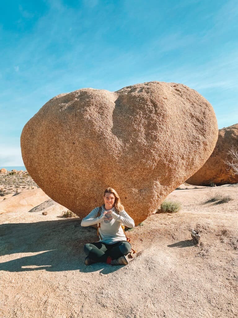
3. Heart Rock
Distance: 1.7 Miles Out and Back
Difficulty: Easy
Heart Rock is another popular must-see stop in Joshua Tree, also located along the Arch Rock Nature Trail. To get here, park at the Arch Rock Nature Trail and cross the street, following the Arch Rock Nature Trail.
Keep your eyes peeled for the signs pointing towards Heart Rock. It’s an easy detour, just remember to hang a left when the trail forks.
You’ll walk between the massive sandstone boulders that Joshua Tree is famous for before spotting Heart Rock, so named because, well, it looks exactly like an emoji heart!
These unique formations were created millions of years ago as liquid magma cooled and formed into granite below the earth’s surface. Over millions of years, water and ice formed the boulders into the shapes you can see today.
From Heart Rock, return the way you came back to the main trail, and walk the short distance to Arch Rock for the perfect 2-in-1 combo hike in Joshua Tree National Park.
Take this itinerary to-go! The downloadable Joshua Tree Itinerary Guide has your perfect 1, 2, or 3 day Joshua Tree trip completely planned for you! With over 20 pages of detailed hiking guides, printable daily itineraries, lodging and dining suggestions and more, you can spend less time planning and more time making epic memories! Check it out, here.

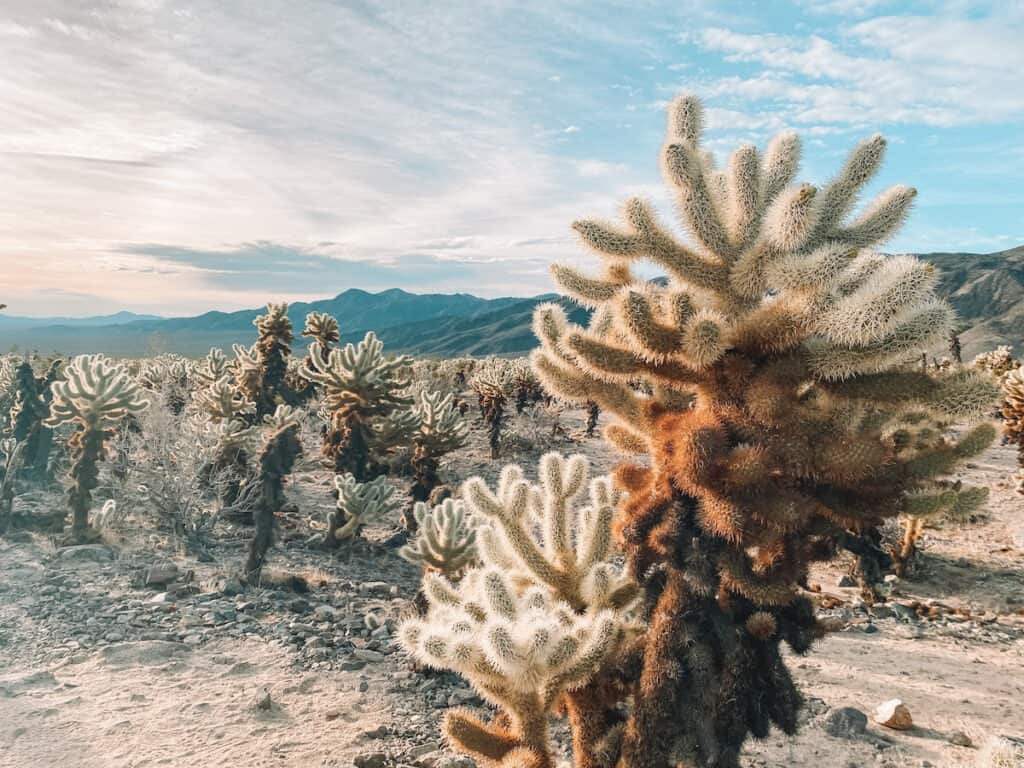
4. Cholla Cactus Garden Boardwalk
Distance: 0.2 Miles
Difficulty: Easy
Don’t be confused by the name: the Cholla Cactus Garden is a naturally occurring field of fluffy-looking (but very prickly) Cactus. The Garden is located on Pinto Basin Road, in the eastern park of the Park. A 1/4 mile boardwalk and trail meanders through the cacti and the whole place feels out-of-this-world.
Set your alarm early for this one. As the rising desert sun creeps over the Eagle Mountains, the Cholla Cactus Garden is illuminated and the spiny cactus appear to “glow.” But remember, as inviting as they may look, don’t touch them. Those spines are as sharp as needles!
For the best photos, plan to arrive at sunrise and stay about 45 minutes to 1 hour to capture the full experience of the “glowing” cactus. There is a large parking lot directly next to the boardwalk.
5. Ryan Mountain
Distance: 2.9 miles out and back
Difficulty: Moderate
Elevation Gain: 1,050 feet
Ryan Mountain in Joshua Tree National Park is a must-see hike for first-timers, and one of my favorite moderately strenuous hikes in Joshua Tree National Park.
The trail is just under 3 miles but has a continuous uphill climb with an elevation gain of just about 1,000 feet, making it a moderately challenging workout to reach the summit.
From the top, the panoramic vista at the summit offers stunning views of Joshua Tree National Park below. On a clear day, you can spot San Jacinto and San Gorgonio peaks, the highest points in Southern California in the distance.
A warning tho, this hike gets VERY hot, even in the winter, and there is virtually no shade! To beat the heat, start your hike early, before 9 am, and come prepared with water, sunblock, and sturdy footwear.

6. Keys Ranch Guided Walk
Distance: 0.5 miles (1.5 Hour Walking Tour)
Difficulty: Easy
Guided Tour only
If you want a taste of history while exploring the rugged beauty of Joshua Tree National Park, I highly recommend the Keys Ranch Guided Walk. This isn’t just a hike; it’s a trip back in time.
Keys Ranch is located in a remote canyon, and is only accessible through a guided ranger tour. Tours are available October – May. Tickets are required and can be reserved ahead of time here, on recreation.gov
Learn more and book Keys Ranch tour reservations, here.
On this short walk, you’ll wander through Keys Ranch, first built in the early 1900s by the hardy Keys family. William and Frances Keys, along with their kids, carved out a thriving existence in this harsh landscape for nearly 60 years, becoming one of the most successful ranching and mining operations in the Joshua Tree area.
The tour lasts about 1.5 hours, and it’s pretty light walking, so it’s perfect if you’re looking for an easier day or have kiddos along. Make sure to bring water and plenty of sun protection.
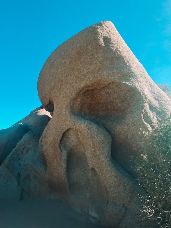
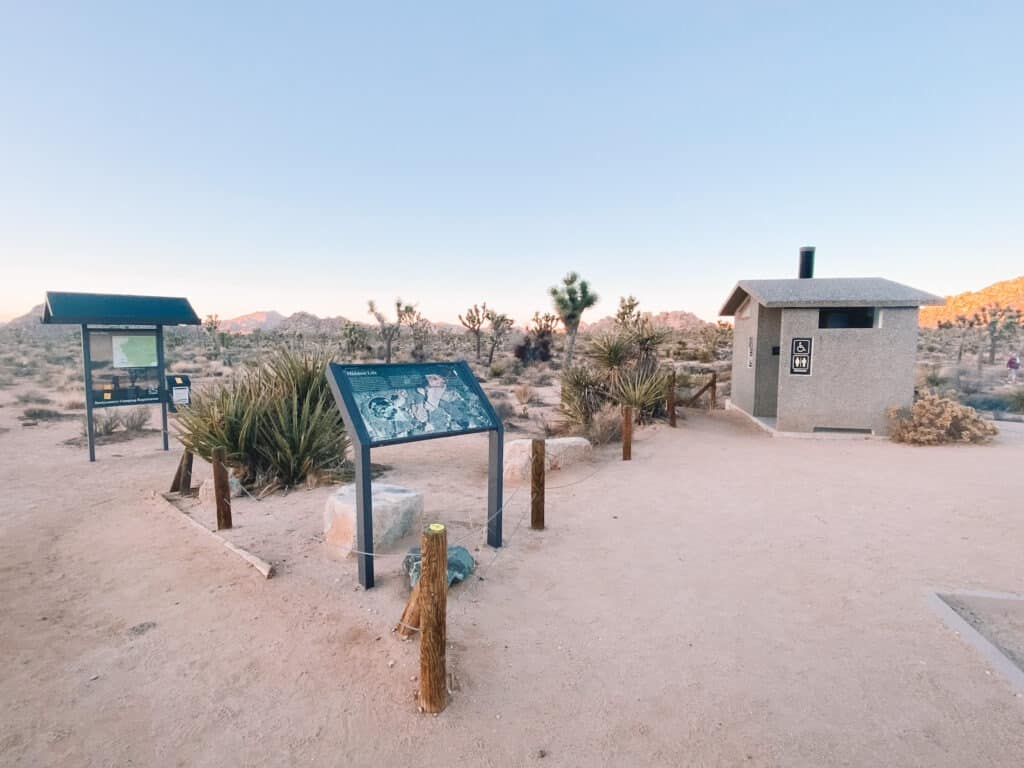
7. Discovery Trail From Skull Rock
Distance: 0.7 miles (loop)
Difficulty: Easy
The Discovery Trail is a great option for those looking for an easy and informative hike, and is conveniently located right next to Skull Rock, one of the Park’s most popular and easily accessible sights. This under 1 mile loop trail takes about 30 minutes to complete.
It’s perfect for families with young children or anyone who wants to learn more about the flora and fauna of Joshua
Follow signs for Skull Rock and park along Park Boulevard. This unique rock formation is located only a few feet from the main road, making it a very popular spot to visit. There’s no mistaking which rock is “Skull Rock” because, well, the name is pretty much spot-on.
From there, cross the street and follow signs for the Discovery Trail. As you meander along the trail, you’re treated to a signature Joshua Tree landscape – a stark, dramatic desert dotted with towering boulder formations and the park’s namesake Joshua Trees.
There are several information signs along the way, explaining a bit about the Park’s geology, plants, and desert animals.
Off-trail exploration is encouraged here, just be sure to climb carefully and avoid climbing on the slick rocks during and after rainfall.
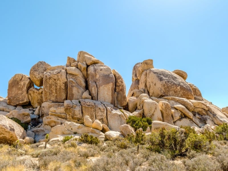
8. Hall of Horrors
Distance: 0.6 Miles
Difficulty: Easy
If you’re an experienced rock climber, you’ll want to spend at least one day at one of Joshua Tree’s many world-famous climbing and bouldering spots. However, even non-climbers can also get in on some of the action here.
The Hall of Horrors is a well-known rock formation popular with climbers, and you can follow a short 0.6-mile dirt trail around the perimeter of the formation. You can also explore off trail in this area, climbing over the labyrinth of rocks and boulders, and even exploring the mini slot canyons.
It’s important to explore carefully, stay on trails where signs indicate, and avoid climbing the rocks when wet for safety reasons.
Take this itinerary to-go! The downloadable Joshua Tree Itinerary Guide has your perfect 1, 2, or 3 day Joshua Tree trip completely planned for you! With over 20 pages of detailed hiking guides, printable daily itineraries, lodging and dining suggestions and more, you can spend less time planning and more time making epic memories! Check it out, here.
9. Desert Queen Mine Trail
Distance: 3.4 Miles
Elevation Gain: 600 Feet
Difficulty: Moderate
Gold fever hit the Joshua Tree area starting in the 1870s. Miners dug hundreds of shafts throughout the area, looking for gold, silver, and other minerals. This moderate trail leads to the ruins one of the last mines to operate in Joshua Tree.
The Queen Desert Mine Trail trail stretches for a moderate 3.4 miles, with a manageable elevation gain of 600 feet, leading to the Queen Desert Mine.
Accessing the trail is a bit of an adventure in itself. You’ll need to navigate the Queen Desert Mine Road, a winding dirt and gravel unpaved road that is popular with 4×4 and off-road divers, but is generally accessible to 2 Wheel Drive cars and sedans. It’s always best to check with Park Rangers about road conditions before heading out.
Never enter any mines or mining equipment while exploring Joshua Tree. A fall into one of these mine shafts can cause serious injury or death. Abandoned mine structures may contain explosives, toxic chemicals, rusted and rotting equipment, or dangerous gases. They’re best enjoyed from a distance!
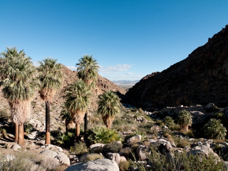
10. 49 Palms Oasis
Distance: 3.1 Miles
Difficulty: Moderate
Elevation Gain: 600′
49 Palms Oasis is one of Joshua Tree National Park’s hidden gems.
Begin your journey at the 49 Palms Oasis trailhead, which is located off Highway 62, near the town of Twentynine Palms. You cannot access this trailhead from other areas of the Park. The trail is a moderate 3-mile round trip, with an elevation gain of 600 feet.
As you trek through the landscape, you’ll encounter rugged canyons and plenty of cacti. The trail ends at a fan palm oasis, a sight that’s a total contrast to the barren desert surroundings. It’s like stumbling upon a secret paradise, complete with palm trees and a spring-fed pool!
Remember, the desert can be unpredictable. Wear sturdy shoes, bring plenty of water, and start early to avoid the midday heat on this exposed hike. Also, stick to the trail to help preserve the area’s delicate ecosystem.
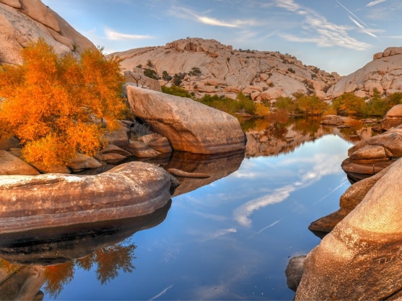
11. Barker Dam Trail
Distance: 1.1 Miles
Difficulty: Easy
Barker Dam Trail is a fantastic option for those seeking a shorter, easier hike in Joshua Tree National Park. The trailhead can be found near the park’s West Entrance, off Barker Dam Road.
Interpretive signs along the trail explain the human and natural history of the area. During the rainy season, there is usually water in the historic reservoir here. But if you’re visiting during the hotter and drier months, don’t be surprised to find this place bone dry.
Keep an eye out along the way for petroglyphs carved in the rocks. This indigenous rock art is visible towards the end of the loop. Make sure to enjoy the art form a distance and NEVER deface or touch rock art.
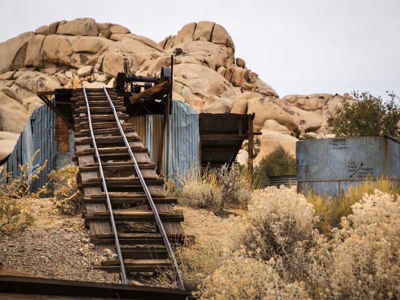
12. Wall Street Mill
Distance: 2 Miles
Difficulty: Easy
If you’re looking for a unique hiking experience in Joshua Tree National Park, the Wall Street Mill Trail is not to be missed! This trail takes you through an old mining area and offers a glimpse into the park’s history.
Starting at the Barker Dam parking lot, follow signs for Wall Street Mill. Along the way, you’ll pass remnants of old mining equipment and abandoned buildings. The highlight of this hike is reaching the Wall Street Mill itself, a well-preserved gold mill that was in operation from 1930 to 1966.
As always, leave no trace and respect the area’s history by not disturbing or taking any artifacts or equipment.
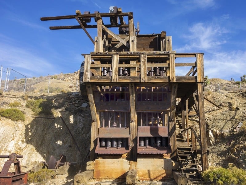
13. Lost Horse Mine
Distance: 4 Miles
Difficulty: Moderate
Elevation Gain: 530′
The Lost Horse Mine Trail is a moderate hike that takes you to the site of an old gold mine, once one of over 300 gold mines located within Joshua Tree. The area’s rich history is filled with gun slingers, cattle rustlers, bandits, and cowboys. The mine is one of the most well preserved mines in any National Park.
Starting at the parking lot near Keys View, follow signs for Lost Horse Mine. Along the way, you’ll pass incredible views of the surrounding landscape. The trail ends at the mine, where you can see the old buildings and learn about its history.
Remember to always stay on designated trails and not disturb any artifacts or equipment. Never enter any mines or mining equipment while exploring Joshua Tree. A fall into one of these mine shafts can cause serious injury or death. Abandoned mine structures may contain explosives, toxic chemicals, rusted and rotting equipment, or dangerous gases. They’re best enjoyed from a distance!

14. Lost Palms Oasis
Distance: 7.5 Miles
Difficulty: Strenuous
Elevation Gain: 1,050′
The Lost Palms Oasis Trail is a longer, challenging hike that takes you through some of the park’s most diverse landscapes to a palm oasis, located in a remote, rocky canyon. This trail requires some scrambling to reach the oasis, and is best suited to more experienced hikers.
The Lost Palm Oasis is located in the southern area of Joshua Tree National Park, near the Cottonwood Visitor Center.
The hike climbs steadily through sandy washes and over dirt and rock through the Park’s arid desert. To reach the oasis, you’ll have to scramble down into the canyon (and of course, back out to leave). Make sure to wear proper footwear and avoid hiking here when rocks are wet.
There is no shade on this trail, so make sure to do this hike early in the day, and avoid it entirely during the hot summer months.
15. High View Nature Trail
Distance: 1.4 Miles
Difficulty: Moderate
The High View Nature Trail is a short, easy loop that offers stunning views of the surrounding desert landscape, located in the Black Rock Canyon area of the Park. This trail cannot be accessed from other areas of the Park.
This is a great hike if you’re staying at the nearby Black Rock Canyon Campground.
The High View Nature Trail climbs steadily past Joshua Trees, Pinyon Pines, and juniper trees to a ridge on the park’s western edge.
16. Boy Scout Trail
Distance: 16 Miles
Difficulty: Strenuous
Elevation Gain: 250′
For a longer hike into Joshua Tree’s backcountry, check out part or all of the moderately difficult 16 mile Boy Scout Trail. For the first couple of miles, the flat trail snakes through Joshua Trees and eventually climbs into a rocky area known as the “Wonderland of Rocks” before ending at the Indian Cove campground at the far north end of the Park.
The Boy Scout Trail is a popular backpacking area, and I highly recommend staying the night out there, especially for beginning backpackers. This is a great area for first-time or beginning backpackers. In fact this trail is where I attempted my first solo backpacking trip! (It didn’t exactly go according to plan 😂 But you can read about that here...)
If you want to hike the Boy Scout Trail as a day hike, consider hiking a few miles out to the Wonderland of Rocks before returning to the trailhead. Or if you have 2 cars, park 1 at the Indian Cove Campground and hike 8 miles one way.

17. California Riding and Hiking Trail
Distance: 37 Miles
Difficulty: Strenuous
The California Riding and Hiking Trail is a long distance backpacking trail that spans 37 miles through Joshua Tree National Park. This trail is known for its scenic views of the desert landscape and diverse plant life, making it a popular choice among experienced backpackers.
The trail is divided into 5 sections, each averaging around 7-8 miles. This makes it easier to plan and complete in smaller segments. However, if you are up for the challenge, completing the entire trail in one trip would be an unforgettable experience.
Be prepared for strenuous hikes with steep inclines and rocky terrain, as well as potentially extreme temperatures. It is important to be well-prepared and knowledgeable about desert backpacking before attempting this trail. There are no water sources on this trail, so you’ll have to cache your water along the route.
Whether you choose to tackle the whole 37 miles or just a section of it, the California Riding and Hiking Trail will definitely provide an adventure-filled experience for any backpacker looking for the ultimate hike in Joshua Tree National Park.

Backpacking and Wilderness Permits in Joshua Tree
Beginning March 1, 2023 Joshua Tree National Park will require wilderness permits for all overnight wilderness camping and backpacking within the park.
Dispersed camping is permitted in designated wilderness zones. Camping must be 1 mile from any Backcountry Trailhead, 1/2 mile from a road, and 200 feet off a trail.
Backpackers along the Boy Scout Trail must camp in one of 14 designated campsites.
Permits are released 6 months in advance and are required year-round. Same-day permits are available online up to 2PM through recreation.gov , and in-person until 4pm at the Permit Office. The Permit Office is located at 74485 National Park Blvd, Twentynine Palms, CA, 92277, Bldg. 100.
Reserve Joshua Tree Wilderness Permits here.
Conclusion
And there you have it, folks – an insider’s guide to exploring the best trails in Joshua Tree National Park!
From family-friendly gems like Hidden Valley to strenuous multi-day treks like the California Riding and Hiking Trail, Joshua Tree is a great National Park for hikers of all levels.
Don’t forget to plan ahead, hydrate, respect the wilderness, and of course, soak in every moment in this weird and wonderful National Park! Here’s hoping you fall in love with Joshua Tree as much as I have. Happy trails!
Explore More National Parks
Get the Ultimate National Parks Planning Guide (for free!) sent to your inbox, full of important planning information, printable packing lists, and the best things to do in all 63 National Parks.
Big Bend: Epic Big Bend Itinerary Guide
Bryce Canyon: One Epic Day in Bryce Canyon National Park
Cuyahoga Valley: 17 Best Things to Do in Cuyahoga Valley National Park
Great Smoky Mountains: The Ultimate Great Smoky Mountains Itinerary in 2 Days
Joshua Tree: The Perfect Day Trip to Joshua Tree National Park
New River Gorge: The Best Hikes in New River Gorge National Park
Yosemite: Epic Yosemite 2 Day Itinerary – How to Spend 2 Perfect Days in Yosemite

