
With stunning red rock canyon vistas around every corner, soaring sandstone cliffs and narrow slot canyons, Zion National Park is a jewel of the National Park system. This in-depth guide covers the closest airport to Zion, driving directions, and includes everything you need to know about how to get to Zion National Park.
Disclosure: This page may contain affiliate links where I earn a small commission from any purchase – at no extra cost to you. This commission helps keep Brooke In Boots up and running. As always, all opinions are 100% honest and my own!
A Quick Look at the Closest Airport to Zion & How to Get to Zion National Park
As this guide covers more in depth further on, visitors to Zion will need to fly to one of the closest major airports to Zion, rent a car, and drive to the Park.
The closest airport to Zion National Park St. George Regional Airport.
>> Click here to book a flight to St. George, Utah
The closest major airports to Zion National Park are Las Vegas Harry Reid International Airport and Salt Lake City International Airport.
>> Click here to book a flight to Las Vegas
Las Vegas Airport is my pick for the best airport for visiting Zion National Park. In my experience, the flights in and out of Vegas are by far the cheapest no matter where you’re flying from and there are tons of easy rental car options.
These airports and other options are described in more detail below.
The closest town to Zion is Springdale, Utah. Zion National Park is located approximately 3 hours from Las Vegas and 5 hours from Salt Lake City.
Zion is located within a days’ drive of several other iconic National Parks and scenic areas, including Bryce Canyon, the Grand Canyon, Arches, Canyonlands and Capitol Reef.
More Resources on Visiting Zion & Bryce Canyon
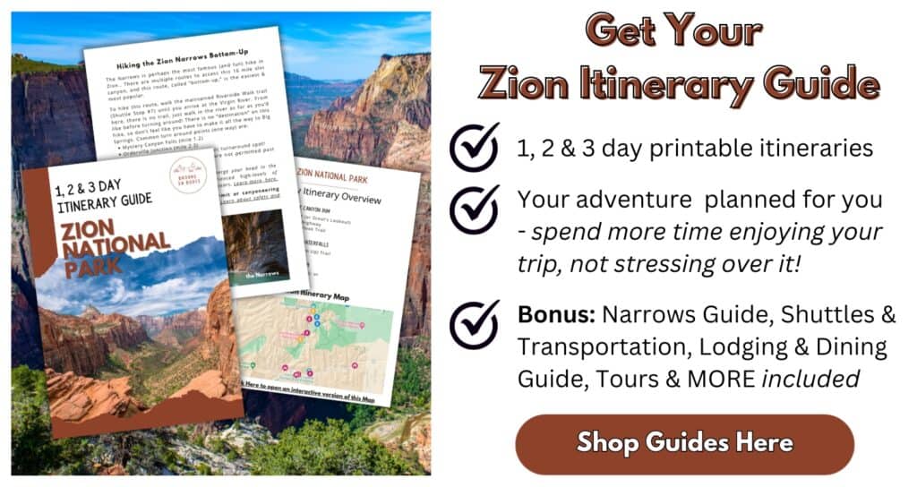
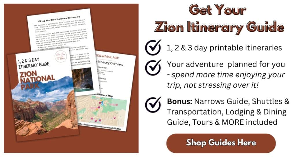
Epic Zion National Park Itinerary Guide
7 Easy Family-Friendly Hikes in Zion National Park
One Epic Day in Bryce Canyon National Park
Zion Permits & Reservations: Everything You Need to Know
Adventure-Packed 7-Day Southern Utah Itinerary: Zion, Kanab & Beyond
Escaping the Crowds by E-Biking in Zion National Park

Where is Zion National Park Located?
Zion National Park is located in southwestern Utah, near the borders of Arizona and Nevada.
The Park sits on the edge of the vast Colorado Plateau. The Colorado Plateau, stretching from southwestern Utah to the Rockies, is home to many of the Southwests most famous National Parks and landmarks, including the Grand Canyon, Arches, and of course, the red sandstone cliffs of Zion.
The awe-inspiring scenery and world-famous hikes and canyon climbs makes Zion one of the most popular National Parks in the United States
This map shows the nearest roads, major towns, and other Parks near Zion National Park.

Closest Cities to Zion National Park
The closest major cities to Zion National Park are:
| City | Distance to Zion Canyon Visitor Center |
|---|---|
| St. George, UT | 42 mi / 45 Minutes |
| Cedar City, UT | 58 mi / 1 Hour |
| Page, AZ | 115 mi / 2.5 Hours |
| Las Vegas, NV | 172 mi / 3 Hours |
| Flagstaff, AZ | 248 mi / 4.5 Hours |
| Salt Lake City, UT | 315 mi / 5 Hours |
The closest small and mid-sized towns to Zion National Park are:
| Town | Distance to Zion Canyon Visitor Center | Services Available |
|---|---|---|
| Springdale, UT | 2 mi / 5 Minutes | Lodging, Gas, Food, Gear Outfitters and Tour Operators |
| Virgin, UT | 25 mi / 20 Minutes | Lodging, Gas & Food |
| Hurricane / La Verkin, UT | 23 mi / 30 Minutes | Lodging, Gas & Food |
| Kanab, UT | 42 mi / 1 Hour | Lodging, Gas, Food, Famous for slot canyons and off-road trails |
Zion Canyon is the heart of Zion National Park, where most visitors will want to spend most of their time. The closest town to Zion Canyon is Springdale, Utah.
Springdale is located directly outside the southern entrance to Zion National Park. In Springdale you’ll find plenty of hotels, vacation rental homes, cute restaurants, gas stations, shopping, and gear and tour outfitters.
Nearby towns of Virgin, Hurricane, and La Verkin are located 20 to 30 minutes from the south entrance. Here you’ll find more chain hotels, some restaurants, gas, and even glamping resorts. The prices are a little better here, since you’re further from the Park.
Further afield, the town of Kanab, Utah is 1 hour from Zion Canyon via the east entrance.
Kanab is famous for the slot canyons you can explore here. Kanab has a small selection of chain hotels, some restaurants, and tour operators to explore the nearby slot canyons like PeakABoo Slot Canyon and state parks, like Coral Pink Sand Dunes.
Want to learn more about planning an epic National Parks trip? Grab my free Ultimate National Parks Planning Guide, including 70+ pages of National Park packing checklists, planning tips, and everything you need to know to start planning a trip to all 63 National Parks!
Closest Airport to Zion National Park
Unless you already live or are traveling in the Southwest, most visitors to Zion will want to fly into one of the closest airports to Zion, rent a vehicle, and drive to the Park.
While southwest Utah is a fairly remote area in terms of airports, Zion is still accessible within a few hours drive of several major airports.
The closest airport to Zion is St. George Regional Airport.
However, the best airport for visiting Zion National Park is Las Vegas Harry Reid International Airport.
These are the closest airports to Zion National Park. Additional details on each of these airports, including rental car options, are included below.

| Airport | Distance to Zion Canyon Visitor Center |
|---|---|
| St. George Regional Airport (SGU) | 47 mi / 1 Hour |
| Cedar City Regional Airport (CDC) | 61 mi / 1 Hour 5 Min |
| Las Vegas Harry Reid International Airport (LAS) | 172 mi / 3 Hours |
| Salt Lake City International Airport (SLC) | 315 mi / 5 Hours |
St. George Regional Airport (SGU) to Zion National Park
St. George Regional Airport is the closest airport to Zion National Park. The airport is located in St. George, Utah, about 1 hour from Zion Canyon Visitor Center.
St. George is a very small regional airport. It is not usually the cheapest or most convenient direct flight for getting to Zion, but if you’re looking to land as close and possible to the National Park, this airport is your best bet.
>> Click here to book your flight to St. George <<
St. George is serviced by SkyWest Airlines, which is a codeshare for Delta, American Airlines, and United Airlines.
Rental cars are available from Enterprise, Hertz, Budget, National and Sunnycars.
Cedar City Regional Airport (CDC) to Zion National Park
Cedar City Regional Airport is a small airport located approximately 1 hour from Zion Canyon. The town of Cedar City has restaurants, gas, and several chain hotels. Because it is such a small airport, flights in and out of here are usually expensive and infrequent.
Delta Airlines is currently the only commercial airline operating out of Cedar City.
>> Click here to book your flight to Cedar City <<
There are two rental car counters at Cedar City Airport: Avis/Budget and Enterprise. Because of limited stock, it is strongly recommended to make rental reservations in advance.
Las Vegas Harry Reid International Airport (LAS) to Zion National Park
Harry Reid International Airport aka Las Vegas Airport, is the closest major international airport to Zion National Park.
Las Vegas is my pick for the best airport for visiting Zion National Park. The flights here are much cheaper and more frequent than the other regional airports. There is a huge rental car selection at this airport, and it’s a relatively easy drive to get to Zion and Springdale.
Of course, you’ll have an opportunity to cruise the strip, try a hand of blackjack, or take part in Vegas’s famous nightlife – if you’re into that sort of thing. Once you get tired of the casinos and neon, check out nearby Valley of Fire State Park and Red Rock Canyon. Both state parks are easily accessible from LAS.
>> Click here to book your flight to Las Vegas
Harry Reid International Airport is served by Alaska, Allegiant, American, Breeze, Delta, Jet Blue, Southwest, Spirit, Suncountry, United, Virgin, Volaris, and West Jet, as well as multiple international carriers.
Rental Cars are available from Alamo, National, Enterprise, Dollar, Sixt, Thrifty, Payless, Budget, Avis, and Hertz.
Salt Lake City International Airport (SLC) to Zion National Park
Salt Lake City International Airport is the second closest major airport to Zion National Park. SLC is. a large international airport with well-priced direct flights throughout the country. If you plan on exploring more of Utah’s National Parks and other sights, this is a great airport to use.
>> Click here to book your flight to Salt Lake City <<
Planning a trip to Zion National Park? Don’t miss this free in-depth Zion itinerary guide, here!
Driving to Zion National Park
Most visitors will drive to Zion National Park. Driving in and around Zion is straightforward and the roads and highways are paved and well maintained.
A 4×4 or AWD vehicle is not required in Zion. But if you plan on exploring nearby Kanab or Paige, other Utah National Parks, you may want to consider a vehicle that can handle off-road or unpaved roads.
Can I take public transportation to Zion? If you are visiting Zion while the Shuttles are operating (Spring-Fall) it’s possible to take a taxi or public transportation to Springdale, then use the free Springdale Shuttle and Zion Canyon Shuttles to access the Zion Canyon area without your own vehicle.
Just remember, only the Zion Canyon area is serviced by shuttles. If you want to visit the Zion-Mt. Carmel Highway, or any trailheads accessed outside the Canyon, you will need your own car or need to arrange a private transfer in Zion.
Read more on the Shuttles in the dedicated “Getting Around Zion” section, below.
Directions to Zion from Las Vegas and St. George

Driving to Zion National Park from Las Vegas, the closest major airport to Zion National Park, is very easy and straightforward. The drive from Las Vegas to the Zion Canyon Visitor Center is 172 miles takes about 3 hours.
From Las Vegas, take Interstate 15 North. Take exit 16 for State Route 9 East. Continue on State Route 9 for 33 miles. In La Verkin, Utah, stay to the right to continue on State Route 9 for another 20 miles before entering Zion National Park, on State Route 9.
Directions to Zion from Salt Lake City and Cedar City
The Drive from Salt Lake City to Zion Canyon Visitor Center is 315 miles taxes about 5 hours.
From Salt Lake City, take Interstate 15 South. Take exit 27 and stay to the left for Route 17 South for approximately 25 miles. . In La Verkin, Utah, stay to the right to continue on State Route 9 for another 20 miles before entering Zion National Park, on State Route 9.
Directions to Zion from Bryce Canyon National Park
Stunning Bryce Canyon National Park is located 85 miles (2 hours) from Zion Canyon. Consider adding a day trip to Bryce on your Zion National Park itinerary.
If you’re driving to from Bryce Canyon National Park, you will enter Zion National Park through the Zion-Mt. Carmel Highway.
If you are driving an RV, trailer, or other oversized vehicle, make sure to read the restrictions under the “Zion-Mt. Carmel Highway Vehicle Restrictions” section, below.
Head towards Zion on State Route 63 North. Take a left on State Route 12 West, and continue for 81 miles. Take another left on US Route 89 South for 67 miles. At Mt. Carmel Junction, take a right onto State Route 9, the Zion-Mt. Carmel Highway.
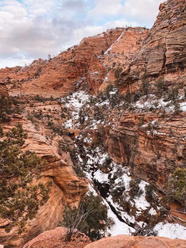
The Zion-Mt. Carmel Highway enters the Park through the east entrance and winds through red rock canyons and rock formations. Continue on State Route 9 West towards the visitor center and town of Springdale.
Directions to Zion from Kanab, Utah and Page, Arizona
If you’re driving to Zion from the nearby outdoor recreation towns of Page, Arizona and Kanab, Utah, you will enter Zion National Park through the Zion-Mt. Carmel Highway.
The town of Kanab, Utah is located 42 miles, or 45 minutes from the Zion Canyon Visitor Center. The town of Page, Arizona is located 116 miles, or 2 hours 20 minutes from the Zion Canyon Visitor Center.
If you are driving an RV, trailer, or other oversized vehicle, make sure to read the restrictions under the “Zion-Mt. Carmel Highway Vehicle Restrictions” section, below.
Follow US Route 89 North towards Zion National Park. At Mt. Carmel Junction, take a left onto State Route 9, the Zion-Mt. Carmel Highway.
The Zion-Mt. Carmel Highway enters the Park through the east entrance and winds through red rock canyons and rock formations. Continue on State Route 9 West towards the visitor center and town of Springdale.

Directions to Zion from the Grand Canyon – North Rim
From the North Rim of the Grand Canyon, it is 121 miles or 2 hours 45 minutes to Zion National Park.
Make sure to read the restrictions under the “Zion-Mt. Carmel Highway Vehicle Restrictions” section, below, if you are driving an RV, trailer, or other oversized vehicle,
From the North Rim, travel on State Route 67 North. Take a left on State Route 89A North and continue for 78 miles. At Mt. Carmel Junction, take a left onto State Route 9, the Zion-Mt. Carmel Highway.
The Zion-Mt. Carmel Highway enters the Park through the east entrance and winds through red rock canyons and rock formations. Continue on State Route 9 West towards the visitor center and town of Springdale.
Directions to Zion from the Grand Canyon – South Rim
From the much more popular South Rim of the Grand Canyon, it is 253 miles or 5 hours to Zion National Park.
Bringing a trailer, RV, or oversized vehicle? Make sure to read the restrictions under the “Zion-Mt. Carmel Highway Vehicle Restrictions” section, below.
From the South Rim, travel on State Route 64 East. In Cameron, Arizona, take a left on US Route 89 North. Travel on US 89 North for just under 200 miles. At Mt. Carmel Junction, take a left onto State Route 9, the Zion-Mt. Carmel Highway.
The Zion-Mt. Carmel Highway enters the Park through the east entrance and winds through red rock canyons and rock formations. Continue on State Route 9 West towards the visitor center and town of Springdale.
Getting Around Zion National Park
In addition to planning how to get to Zion National Park, there are a couple of important things to know about getting around the Park. This section covers how and when to use the Zion Canyon Shuttle, biking around Zion, as well as shuttles into the Park from Springdale, and vehicle restrictions on the Zion-Mt. Carmel Highway.
Entrances to Zion National Park
There are three main vehicle entrances to Zion National Park:
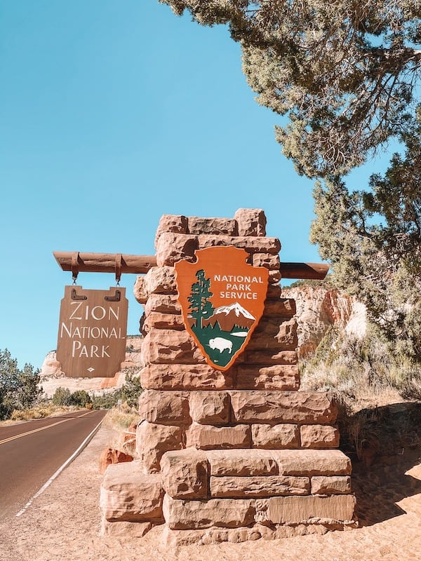
The South Entrance on State Route 9 is the most popular entrance, and the most direct access to Zion Canyon. The South Entrance enters the Park in the town of Springdale, Utah.
The East Entrance also enters the Park on State Route 9 through the Zion-Mt. Carmel Highway and Tunnel. This entrance is the most direct access to trailheads along the eastern side of the Park, including the Canyon Overlook and East Mesa Trail.
Finally, the Kolob Canyon Entrance is located off Interstate 15 in the northwestern Kolob Canyons district of the Park. It is not possible to access Zion Canyon from this entrance.
Map of Visitor Centers & Entrances to Zion National Park
This map shows the locations of the main vehicle Entrances and Visitor Centers in Zion National Park.
Cell phone service and wifi are unavailable in most areas of the Park. Consult a map, like the one above, before leaving on your trip and always carry an offline map for directions!
Visitor Centers in Zion National Park
There are two visitor centers located inside Zion National Park.
The Zion Canyon Visitor Center is the largest and most popular visitor center in the Park. The Zion Canyon Visitor Center includes indoor and outdoor exhibits, a bookstore and a wilderness desk for picking up canyoneering and backpacking permits.
The Zion Canyon Visitor Center is open 365 days a year, with extended hours from May – September. Check Visitor Center hours, here.
The Zion Canyon Visitor Center is located off State Route 9 (Zion Park Blvd) just inside the South Entrance.
The Kolob Canyons Visitor Center is located in the Parks remote northwestern corner. Here you can explore box canyons, scenic drives, and backcountry adventure with far fewer crowds than Zion Canyon.
All visitors must to the Kolob Canyons district must stop at the Visitor Center to pay the Park Entrance Fee or show an Interagency Pass. Kolob Canyons Road and Visitor Center may close in winter due to snow and ice. Check Park Conditions, here.
The Kolob Canyon Visitor Center is located on Kolob Canyons Road, off Interstate 15, 17 miles south of Cedar City, Utah.
Zion Canyon Shuttle
Zion Canyon Scenic Drive is closed to private cars when the Zion Canyon Shuttle is running.
The shuttle typically operates daily from March through November, as well as during the December holidays. That means you’ll likely be using the Shuttle when visiting most of your stops on this Zion National Park itinerary.

Guests of the Zion Lodge can drive on Zion Canyon Scenic Drive in order to access the Lodge.
The Zion Canyon Shuttle connects the Zion National Park Visitor Center with trailheads and sights along the Zion Canyon Scenic Drive. Most visitors board at the Visitor Center. Guests staying at the Zion Lodge can also board the bus to go up canyon from the Zion Lodge Shuttle Stop (#5).
Stops include: The Zion Canyon Visitor Center (Stop #1); the Zion Human History Museum (#2); Canyon Junction (#3); Court of the Patriarchs (#4); Zion Lodge (#5) – stop here for the Emerald Pools; The Grotto (#6) – stop here for Angel’s Landing; Weeping Rock (#7); Big Bend (#8); and The Temple of Sinawava (#9), stop here for the Narrows.
To board the shuttle, park at the visitor center (arrive early!) or take the free Sprindgale Shuttle.
Springdale Shuttle
The Springdale Shuttle runs through the town of Springdale and provides service to Zion’s pedestrian and bike entrance, a short walk from the Zion Canyon Visitor Center.
This Shuttle is free to use and runs April – October.
The Springdale line makes 9 stops along Zion Park Blvd (Utah Scenic Byway 9) throughout the town of Springdale. Most stops are located at popular hotels and restaurants. If you are within walking distance of the main road through town, Zion Park Blvd, chances are there is a Shuttle stop within easy walking distance.
If you aren’t staying in Springdale, you can park in one of the several paid parking lots around town and walk to the nearest shuttle stop.
Zion-Mt. Carmel Highway Vehicle Restrictions
The narrow and winding Zion-Mt. Carmel Tunnel was built well before modern RV’s and trailers became commonly used recreation vehicles. A 1989 study found that large vehicles cannot navigate the Tunnel without crossing the double yellow line, leading to several accidents and near-misses.
As a result, all large vehicles must be escorted through the Zion-Mt. Carmel tunnel by an NPS Ranger. The ranger escort will temporarily limit tunnel traffic to one-way, to ensure safe passage.
A $15 tunnel permit is required to drive all vehicles over 7 feet 10 inches (2.4 meters) in width and/or 11 feet 4 inches (3.4 meters) in height or larger through the tunnel.
Large vehicle permit holders are only permitted to drive the Tunnel during posted seasonal hours. A ranger will assist oversized vehicles in safely navigating the narrow, winding tunnel. Learn more about Zion-Mt. Carmel Tunnel permits, here.
Gas & Services in Zion National Park
There are no gas stations or vehicle services inside Zion National Park. The closest gas stations to Zion Canyon are located in the town of Springdale, Utah.
There are no grocery stores inside Zion. There area number of major grocery stores and many restaurants in the town of Springdale.
The Red Rock Grill restaurant inside the Zion Lodge is open for breakfast-dinner. The Castle Dome Cafe, also at the Zion Lodge, provides to-go breakfasts and lunch.
Biking Around Zion
Want to skip the crowded shuttle line? During busy times wait times to board the shuttle from the Zion Visitor Center can be over an hour! During my last visit to Zion in April, I heard that visitors were waiting over 2 hours to get on the shuttle bus!
The solution? Rent an ebike! Bicycles and Class 1 eBikes (aka pedal assist bikes) are permitted on all paved roads and the Pa’rus Trail inside Zion National Park.
On an eBike you’ll be able to cruise from Springdale right into Zion without waiting for the Shuttle Line.
It’s 8 miles from the Pedestrian Entrance to the end of Zion Canyon Scenic Drive at the Temple of Sinawava (aka the entrance to the Narrows hike). All shuttle stops and major trailheads have bike racks, so you can get off and explore at your own pace.
There are tons of eBike and regular bicycle rentals throughout Springdale.
More Resources on Visiting Zion & Bryce Canyon
Epic Zion National Park Itinerary Guide
7 Easy Family-Friendly Hikes in Zion National Park
One Epic Day in Bryce Canyon National Park
Zion Permits & Reservations: Everything You Need to Know
Adventure-Packed 7-Day Southern Utah Itinerary: Zion, Kanab & Beyond

