
Towering sandstone cliffs, winding slot canyons, and some of the most iconic landscapes in the United States—welcome to Southern Utah, an outdoor adventurer’s dream and one of my favorite places in the U.S. to explore!
Whether you’re here to hike through Zion’s epic canyons, explore the hoodoos of Bryce Canyon, or discover hidden gems in Kanab, this 7-day southern Utah itinerary will take you through the best of it all.
This itinerary is perfect for first-time visitors and families or adults looking for a mix of adventure, scenery, and relaxation. Get ready for jaw-dropping viewpoints, unforgettable hikes, and some of the coolest small towns in Utah.
Let’s dive in!
Disclosure: This page may contain sponsored content or affiliate links, including Amazon links, where I earn a small commission from any purchase – at no extra cost to you. This commission helps keep Brooke In Boots up and running. As always, all opinions are 100% honest and my own!
A Quick Look at Your 7-day Southern Utah Itinerary
- Day 1: Fly to Las Vegas or Salt Lake City. Drive to Springdale, Utah with optional stops at Valley of Fire State Park (Nevada) or Kolob Canyons District. Overnight Springdale.
- Day 2: Explore Zion’s famous river hike, the Zion Narrows. Overnight Springdale.
- Day 3: Climb the canyon on the Angel’s Landing, Scouts Lookout or Observation Point Trail, followed by a drive on the Zion-Mt. Carmel Scenic Highway. Overnight Springdale.
- Day 4: Day Trip to Bryce Canyon National Park to hike among the hoodoos.
- Day 5: Drive to Kanab, Utah while stopping to ride the dunes at Coral Pink Sand Dunes State Park
- Day 6: Explore natural wonders around Kanab, like Peek-A-Boo Slot Canyon, the Great Chamber, and Sand Caves
- Day 7: Return to Las Vegas or Salt Lake City for your flight home!

Getting to Southern Utah
The best way to kick off your Southern Utah adventure is by flying into Las Vegas (LAS) or Salt Lake City (SLC) and renting a car. Here’s what you need to know:
✈ Las Vegas (Best Option): Most travelers fly into Vegas because it’s closer to Zion and often has cheaper flights and tons of rental car options. From here, it’s a 3-hour drive to Zion, including a quick detour to Valley of Fire State Park (which you should definitely do!).
✈ Salt Lake City (Second Best Option): If flights to SLC are cheaper, or you want a scenic road trip through Utah, this is a solid choice. It’s a 4.5-hour drive to Zion, but you can break it up with a stop at Kolob Canyons, a stunning but lesser-visited section of Zion National Park.
🚗 Rental Cars: Both LAS and SLC have tons of rental car options, so you won’t have trouble finding one. A high-clearance 4×4 vehicle isn’t required for this itinerary, especially if you plan to explore Kanab on a guided tour (highly suggested), but if you’re planning any off-road adventures, consider an SUV. For 4×4 off-road adventures in Kanab, I strongly suggest you rent an ATV/UTV or go with a guided tour – details on all those options are provided below!
Where to Stay on Your Utah Adventure
You’ll be staying in two main areas during this trip: Springdale (Zion National Park) and Kanab. Here are the best options for each budget and travel style.
Where to Stay in Springdale (Zion National Park)
- Zion Canyon Lodge – The only lodging inside Zion National Park. If you want to wake up in the park and spend the max amount of time in Zion, this is your best bet.
- SpringHill Suites by Marriott – One of the best options in Springdale! Great views, a pool, and free breakfast.
- Best Western Plus Zion Canyon Inn & Suites – A budget-friendly pick with pools, free WiFi, and a solid location.
- Cable Mountain Lodge – A more upscale option with epic sandstone views and river access—perfect for a relaxing stay.
Where to Stay in Kanab
- Best Budget Option: Comfort Suites Kanab National Park Area – Clean, comfy, and affordable!
- Best Mid-Range Option: Canyons Boutique Hotel – A charming boutique stay with a great location in Kanab.
- Best Glamping & Luxury: Cave Lakes Canyon Ranch – For a unique stay, try luxury glamping in a canyon!
- Best Pet-Friendly Option: Best Friends Roadhouse & Mercantile – If you’re traveling with a pup, this is the place to stay.
Looking for more ideas and info on where to stay in Kanab? Check out my Kanab lodging guide, here.
Take this info to-go! The Zion Itinerary Guide has your perfect 1, 2, or 3 day Zion trip completely planned for you! With over 20 pages of detailed hiking guides, printable daily itineraries, lodging and dining suggestions and more, you can spend less time stressing and more time making epic memories! Check it out, here.
Day 1: Fly to Vegas or SLC, Drive to Zion (Stop at Valley of Fire or Kolob Canyons)
Your adventure begins! After landing in Las Vegas or Salt Lake City, it’s time to hit the road toward Zion National Park. Depending on where you fly in from, you’ll have two different scenic detours to consider.
🛬 Option 1: Flying into Las Vegas (Best Choice)
- From Las Vegas, drive 1 hour to Valley of Fire State Park.
- Spend an hour or two exploring this incredible red rock landscape. Don’t miss:
- Fire Wave Trail (1.3 miles, easy) – A short hike to a stunning wave-like sandstone formation.
- Elephant Rock (short walk from the road) – A unique rock formation shaped like an elephant!
- The Beehives – Cool layered sandstone formations right by the entrance.
- Continue the drive 2 more hours to Springdale, Utah (or 2 hours 45 minutes if skipping Valley of Fire).
Time Zone Alert! Las Vegas is on Pacific Time, but Utah is on Mountain Time (1 hour ahead). Keep this in mind when planning return flights!


🛬 Option 2: Flying into Salt Lake City
- From Salt Lake City, it’s a 4.5-hour drive to Springdale on I-15.
- A great stop along the way is Kolob Canyons, a less crowded but stunning part of Zion. It’s just 4 hours from SLC and directly on your route.
- Must-do: Drive the Kolob Canyons Scenic Drive and stretch your legs on:
- Timber Creek Overlook Trail (1.1 miles, easy) – A quick hike with panoramic views of Kolob Canyons.
- From Kolob Canyons, it’s 45 more minutes to Springdale.

Before Checking In: Grab Your Narrows Gear (Optional)
If you plan to hike The Narrows tomorrow and want to rent waterproof gear, swing by Zion Outfitters or another outfitter in Springdale before checking into your hotel. You can rent waterproof boots, neoprene socks, and a walking stick—which you’ll need if the water is cold or deep! It’s perfectly possible to hike the Narrows in your own gear – and I’ve included what I suggest bringing below.
Grab some dinner at some of the many restaurants in town. Some local favorites are: Oscar’s Cafe (Tex Mex, lunch and dinner), Spotted Dog (American, lunch and dinner) or Whiptail Grill & Cocktails (lunch & dinner – one of my personal faves) and the Zion Canyon Brew Pub (lunch & dinner, located next to the Zion Pedestrian Entrance and Visitor Center).
Get to bed early – you have a big day exploring Zion tomorrow!
Day 2: Hike The Zion Narrows
Rise and shine! Today, you’re tackling one of the most iconic hikes in any U.S. National Park—The Narrows.
This bucket-list-worthy slot canyon lets you hike directly through the Virgin River, with towering sandstone walls rising thousands of feet around you. It’s awe-inspiring, refreshing, and totally unforgettable.

How to Hike The Narrows (Bottom-Up Route)
📍Narrows / 0-9 Miles / Moderate – Strenuous /(AllTrails Trail Map)
Need a map? Don’t forget to download your map and save it to your phone or GPS device before your hike! Get AllTrails Plus or AllTrails Peak (the most used trail app on my phone!) to download all your trail maps for offline use. Use my promo code brookeinboots30 to get 30% off your annual AllTrails subscription!
There are multiple ways to explore The Narrows, but this guide covers the “bottom-up” route, which is the most popular and doesn’t require a permit or technical canyoneering skills.
To reach the trailhead: Park at the Visitor Center Parking lot, or take the Springdale Shuttle to the Visitor Center. Take the Zion Shuttle all the way to the last stop (#9), Temple of Sinawava.
From here, walk 1 mile on the paved Riverside Walk to reach the river.
To hike this route, walk the maintained Riverside Walk trail (Shuttle Stop #7) until you arrive at the river.
From here, there is no trail, just walk in the river as far as you’d like before turning around! There is no “destination” on this hike, so don’t feel like you have to make it all the way to Big Springs.
Common turnaround points are:
- Mystery Canyon Falls (mile 1.2)
- Orderville Junction (mile 2.3)
- Wall Street (mile 3.7) This is a scenic turnaround spot!
- Big Springs (mile 4.5) Day hikers are not permitted past here.
🚨 Flash Flood Risk – Check the weather forecast and flash flood potential before hiking. Even distant rainstorms can cause life-threatening floods.
💀 Toxic Algae Alert – DO NOT drink or filter water from the Virgin River, and avoid submerging your head. Cyanobacteria blooms can be deadly. Stay up to date on conditions here.

What to Wear & Bring for The Narrows
Yes, you WILL get wet. Depending on conditions, you might be wading through ankle-deep, knee-deep, or even waist-deep water.
Wear moisture-wicking layers you don’t mind taking a swim in (not jeans or cotton), and don’t forget to bring a warm layer jacket – it gets chilly in the shaded canyon, even in summer. For shoes, it’s best to choose sturdy, closed-toed shoes with a good grip like hiking boots, trail runners, or canyoneering boots. Some hikers opt to wear closed-toe water sandals, but the riverbed is full of small sharp rocks and slippery boulders, so I was glad for the stability and production of real shoes.
Trekking poles will help you keep your balance, and a dry bag will keep your electronics, snacks, and warm layers safe if you take a fall or have to wade through high water.
Where to Rent Gear in Springdale
Need waterproof boots, neoprene socks, or dry suits? Rent them from Zion Outfitter right outside the park entrance. Highly recommended in early spring, late fall, or after heavy rains.
Lunch Break: Refuel After Your Hike
After finishing The Narrows, hop back on the shuttle and grab lunch. I suggest packing a picnic to enjoy on the lawn in front of Zion Lodge or grab quick-service burgers and fries at the Castle Dome Cafe, located at the Zion Lodge.

Optional Afternoon Hike: Lower Emerald Pools Trail
If your legs still have some energy, Lower Emerald Pools is a great easy add-on hike:
🥾 Lower Emerald Pools – 1.5 miles round trip, easy. A short, scenic hike to a waterfall and lush pools. Good for families.
🥾 Middle & Upper Emerald Pools – 3 miles round trip, moderate. A bit more climbing and some moderate scrambling but stunning views.
🚧 2025 Update: Bridge Closure
The bridge from Zion Lodge (Shuttle Stop #5) to Emerald Pools is closed indefinitely due to structural issues. To reach the Emerald Pools trail during this time, walk or take the shuttle to Shuttle Stop #6 (The Grotto), which adds an extra 0.5 miles. You can check for updates and current trail conditions, here.

Day 3: Angel’s Landing or Scout’s Lookout + Ebikes + Scenic Drive
Your second day in Zion is all about adventurous hikes and absolutely epic canyon views! Get an early start to beat the heat and the crowds.
Just like yesterday, you can take the shuttle to the trailhead, but if you want a more flexible (and fun!) way to explore, consider renting an e-bike. Biking through Zion Canyon is one of the most scenic ways to experience the park, and you’ll have the freedom to stop wherever you’d like.
Learn more about e-biking in Zion and how I – a total skeptic – was converted!
Choose Your Own Adventure: Angel’s Landing, Scout’s Lookout, or Observation Point
Depending on your hiking abilities, tolerance for risk, or fear of heights, there are a few different hikes to consider today:
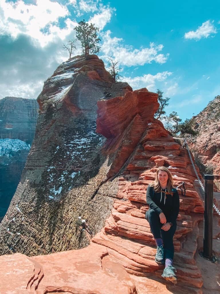
Angel’s Landing (Strenuous, 5 hours, Permit Required)
- Distance: 4.3 miles round trip
- Elevation Gain: 1,850 feet
- Permit Required: Yes
- AllTrails Trail Map
Dubbed “The Most Dangerous Hike in America,” this legendary trail takes you up Walter’s Wiggles—21 steep switchbacks—before reaching Scout’s Lookout. From here, only permitted hikers can continue the final 0.5 miles of sheer exposure, traversing a narrow ridge with 1,000-foot+ drop-offs on either side, using anchored chains for support.
Angel’s Landing Permits
A permit is required for all hikers traveling beyond “Scout’s Lookout” to Angel’s Landing (aka all “chains” sections). A permit is NOT required to visit Scout’s Lookout. Learn more about Angel’s Landing Permits and Zion Reservations in my in-depth guide, here.
Angel’s Landing permits are issued online by lottery on recreation.gov. Most lottery permits will be issued through quarterly preseason lotteries. A select number of permits will be issued in daily day-before lotteries.
Day-before lottery applicants should apply on recration.gov between 12:01AM and and 3PM the day before they intend to hike. Applicants will be notified by 4PM.
Fatalities have occurred, so only attempt this if you’re comfortable with heights. If you have a permit, catch the earliest shuttle (6 a.m. in peak season) to the Grotto shuttle stop and get hiking!

Scout’s Lookout (Moderate, 3 hours, No Permit Required)
- Distance: 3.6 miles round trip
- Elevation Gain: 1,200 feet
- Permit Required: No
- AllTrails Trail Map
Want the epic views without the fear-factor? Scout’s Lookout follows the same route as Angel’s Landing but stops before the chains section. You’ll still get panoramic views of Zion Canyon without the heart-stopping exposure.
Observation Point via East Mesa Trail (Strenuous, 5 hours, Best View in Zion!)
- Distance: 7 miles round trip
- Elevation Gain: 700 feet
- Permit Required: No
- AllTrails Trail Map
This less crowded alternative to Angel’s Landing looks down on it from above! Traditionally, this hike starts at Weeping Rock, but that route is closed indefinitely due to rockfalls. Instead, you can reach Observation Point via the East Mesa Trail outside the park.
Parking is very limited and the road is sometimes impassible to regular (non 4×4) vehicles. You can also take a shuttle from East Zion Adventures.

Afternoon: Scenic Drive on the Zion-Mt. Carmel Highway
After your hike, hop in the car and head out for a breathtaking scenic drive along the Zion-Mt. Carmel Highway. This route connects Zion Canyon with Bryce Canyon and the Grand Canyon North Rim, and it’s packed with stunning rock formations and overlooks.
Must-See Stops Along the Way:
- Checkerboard Mesa – A uniquely patterned rock formation
- Great Arch – A massive rock alcove towering above the highway
- Canyon Overlook Trail (1 mile, easy-moderate) – A short but stunning hike with views comparable to Angel’s Landing—minus the sheer drop-offs! Don’t miss this hike, its one of my favorites in Zion!
After a long, adventure-filled day, head back to Springdale for a well-earned meal.

Day 4: Day Trip to Bryce Canyon National Park
Today, you’re off to explore Bryce Canyon National Park, home to the largest concentration of hoodoos in the world! Get an early start because it takes about 2 hours to drive from Zion to Bryce without stops.
The Drive from Zion to Bryce
After leaving Zion, the route winds through canyons, high-desert plateaus, and farm valleys, before intersecting US-89 at Mt. Carmel Junction. Take US-89 North, then turn left onto UT-12, a designated National Scenic Byway that leads into Dixie National Forest. Keep your eyes peeled for the first glimpses of hoodoos, sandstone arches, and fiery-red rock formations.
Once you enter Bryce Canyon National Park, drive straight to the Bryce Amphitheater—this is where the most jaw-dropping views of Bryce’s unique landscape are waiting!

http://alltrails.pxf.io/OebjKAMorning: Hike the Queens Garden & Navajo Loop Trail
🥾 Trail Details:
- Distance: 3.1 miles (via Two Bridges) / 3.2 miles (via Wall Street)
- Difficulty: Moderate
- Elevation Gain: 650 feet
- Estimated Time: 2 hours
This iconic loop trail is the best way to experience Bryce Canyon up close. You’ll start at either Sunrise or Sunset Point and descend into the hoodoos, passing E.T. Hoodoo (☎️ home) and Queen Victoria (namesake of Queens Garden) along the way.
This hike is a loop, meaning you can hike in either direction, starting from Sunset Point or Sunrise Point, both along the rim of the Bryce Amphitheater. I recommend hiking clockwise, starting at Sunset point. This direction starts with a steeper downhill and a more gradual ascent back up to Sunrise Point.

At the Navajo Loop junction, you have two options to ascend back up to the canyon rim:
- Two Bridges Route (Open year-round) – Slightly shorter
- Wall Street Route (Closed in winter) – A dramatic, slot-canyon-like section with steep switchbacks
Altitude Warning! You’ll be hiking at 8,000 feet, so expect to feel the burn on the way back up!
Afternoon: Scenic Drive & Viewpoints
As the day heats up, shift to a leisurely drive along the Bryce Canyon Scenic Road—an 18-mile route winding along the canyon rim, past pine forests, and leading to breathtaking overlooks.
In my experience, its easiest to drive straight to Rainbow Point first, then stop at viewpoints on the way back. This way, most stops will be on your right-hand side, making parking easier and avoiding risky left turns.
🌟 Favorite Bryce Canyon Scenic Drive Viewpoints (South to North):
1️⃣ Rainbow Point – Highest elevation in the park, with panoramic views
2️⃣ Yovimpa Point – Overlooks the Grand Staircase-Escalante
3️⃣ Natural Bridge – Stunning red rock arch
4️⃣ Bryce Point – One of the best sunrise spots
5️⃣ Inspiration Point – Unbeatable amphitheater views

Evening: Return to Springdale
After soaking up Bryce’s otherworldly landscapes, head back to Springdale for your final night in Zion. You’ll be checking out of your Springdale hotel tomorrow and headed to your next stop: Kanab, Utah.
Day 5: Drive to Kanab & Coral Pink Sand Dunes State Park
Time to hit the road! Today, you’re heading to Kanab, Utah, but first—you’re making a stop at one of Utah’s most underrated hidden gems: Coral Pink Sand Dunes State Park.

Morning: Drive to Coral Pink Sand Dunes State Park 🚗
The drive from Springdale to Coral Pink Sand Dunes State Park takes about 1 hour, leading you through Utah’s stunning red-rock desert landscapes.
From Springdale, drive east on UT-9 through Zion National Park’s scenic east entrance (this is the same Scenic Drive that you did yesterday).
Turn left onto US-89 North at Mt. Carmel Junction. After 18 miles, turn left onto Hancock Road, which leads to the state park.
Even if you’ve visited Death Valley, Great Sand Dunes, or White Sands, you’ve never seen dunes like this! These vibrant rust-colored dunes stretch for miles, shifting with the wind and creating an otherworldly playground.
🚪 Park Entrance Fee: $10 per vehicle

Afternoon: Explore Coral Pink Sand Dunes 🏜️
Coral Pink Sand Dunes is an adventure lover’s dream! Whether you want to sandboard, ride ATVs, or even rappel into hidden slot canyons, this park has something for everyone.
ROAM Outdoor Adventure Co. is the official tour provider, located inside the Park. In 2024, I went on their rappelling and dune boarding adventure tour, and it’s hands down one of the most fun things I did that entire year!

🔥 Best Things to Do at Coral Pink Sand Dunes:
✔ Sandboarding & Sand Sledding – The park’s most popular activity! You can rent a sandboard or sand sled from the Visitor Center ($25/day, includes wax). Rentals are first-come-first-served, so arrive early!
✔ UTV Riding – Ride up and down the dunes on an off-road vehicle, permitted throughout the park, except in certain conservation areas. Chat with a ranger about where to explore if you’re going on your own, or go with a guide!
✔ Hiking – Explore the rolling dunes on foot.
✔ Canyoneering & Rappelling – Descend into hidden slot canyons (with a guide only).

Evening: Drive to Kanab & Check-In
Once you’ve emptied the sand from your shoes (and probably your clothes too 🤣), drive 30 minutes to Kanab, Utah, your home base for the next two nights.
Kanab is one of the most underrated adventure destinations in the Southwest. Surrounded by National Parks, State Parks, and insane slot canyons, it’s a prime location for exploring Southern Utah’s red-rock country.
🍽 Where to Eat in Kanab:
- Sego – Elevated New American cuisine 🍷
- Escobar’s – Casual Mexican food 🌮 (a local favorite!)
- Rocking V Cafe – A little bit of everything located right on the main street.
Tomorrow, get ready for another epic adventure—you’ll be hiking through some of the most beautiful slot canyons in Utah! 👀🔥

Day 6: Epic Adventures in Kanab – Slot Canyons & Sand Caves
Your second day in Kanab is all about exploring hidden natural wonders, from narrow slot canyons to massive sand caves. Today, you’ll need a 4×4, an ATV, or a guided tour to reach some of these jaw-dropping locations.
There are virtually unlimited things to do in Kanab, Utah, but in my experience, the best bang-for-your-buck is visiting Red Canyon (Peek-A-Boo) Slot Canyon, the Great Chamber at Cutler Point, and if you have time, a quick hike to the Sand Caves. Looking for more ideas or don’t have a 4×4 vehicle? Check out 12 Epic Things to Do in Kanab and Southern Utah.

Morning: Explore Peek-A-Boo Slot Canyon (Red Canyon) 🌄
Most people have heard of Antelope Canyon in Arizona, but Peek-A-Boo Slot Canyon (also known as Red Canyon) is just as stunning—without the massive crowds.
This short and easy slot canyon is less than 1 mile round-trip (although you’ll need some help or the right vehicle to get there). There is no technical climbing through this canyon, making it perfect for families and first-time slot canyon hikers.
Learn more about visiting Peek-A-Boo Slot Canyon (Red Canyon) in my in-depth guide, here.

🚗 Getting There:
Warning: Reaching Peek-A-Boo requires an 8-mile off-road drive through deep sand, only accessible by ATVs, UTVs, or true 4x4s. Even some high-clearance SUVs risk getting stuck (which I saw in person myself!).
👀 Best Options:
✅ Rent an ATV/UTV in Kanab – Check out Kanab Tour Company or Expedition Kanab.
✅ Book a guided tour (ROAM Outdoor Adventure Co. offers a Peek-A-Boo & Great Chamber combo tour—highly recommend!)

Midday: Visit the Great Chamber at Cutler Point 🏜
The Great Chamber is one of those Instagram-famous spots that you think can’t possibly live up to the hype—except, in my opinion it absolutely did!
🌀 What is it?
The Great Chamber is a massive sand cave, sculpted by wind and erosion, with a dramatic arch framing the sky. The swirling sand and golden light make it a dreamy photography spot.

🚙 How to Get There:
Reaching the Great Chamber requires a 4×4 high -clearance vehicle or OHV. Do not attempt to drive here in a regular vehicle – you will get stuck. You can find the location for the parking lot on AllTrails, here, but I’d strongly recommend visiting with a guide.
Several tour guide operators in Kanab, like ROAM and Expedition Kanab offer combo tours to the Chamber and Peek-A-Boo Slot Canyon nearby.
From the parking area, a short but steep 0.25 mile trail ascends the rock formation and takes you direction into the Chamber itself. Be warned that this trail is pretty much all deep sand.
The hike is totally exposed to the sun, so make sure to wear sunscreen and bring plenty of water. This area gets pretty scorching hot in the afternoon, so a visit early in the morning or around sunset is best.

Afternoon: Hike to the Sand Caves 🏕
If you’re looking for a quick and easy adventure, the Sand Caves are the perfect way to end your day in Kanab.
Hidden in the cliffs off Highway 89, the Sand Caves are a short and easy hike to some of the incredible, natural sand caves found throughout the Kanab area.
These hidden caves are made of soft sandstone and have been eroded over time to form intricate, maze-like passageways, with beautiful views of the surrounding canyon.

The hike is short and relatively easy, making it one of the most popular things to do in Kanab for families and non-hikers.
Make sure to wear closed toed shoes with good traction for the short scramble up the sandstone trail into the caves.
Parking for the Sand Caves is located at the turn-off for the Best Friends Animal Sanctuary. Find directions to the parking area, here.
Evening: Relax & Enjoy Kanab 🌅
After an action-packed day exploring slot canyons, sand caves, and epic landscapes, unwind in Kanab at your last night in Southern Utah.

Day 7: Return to Las Vegas or Salt Lake City ✈️
All good adventures must come to an end! Today, you’ll head back to civilization after an epic 7-day road trip through Southern Utah.
🚗 Driving Times to the Airport:
- Kanab → Las Vegas (LAS): ~3 hours (⏳ Reminder: Las Vegas is 1 hour behind Utah! Adjust your clocks and plan accordingly.)
- Kanab → Salt Lake City (SLC): ~5 hours (⏳ Leave extra time for traffic & stops.)
If your flight isn’t until later in the day, consider squeezing in one last quick hike or scenic stop before hitting the road. Otherwise, load up on snacks, fuel up your car, and hit the highway!

More Tips for Your Southern Utah Road Trip 🏜
✔ Book in Advance – Southern Utah is wildly popular, especially during spring break & fall. Secure hotels, campgrounds, and guided tours ahead of time.
💧 Pack More Water Than You Think – The desert is hot & dry (even in cooler months). Always carry extra water in your car and backpack. Salty snacks help replace electrolytes.
🌅 Start Early – Beat the crowds & the heat by hitting trails at sunrise. Many parks get packed by mid-morning!
🚯 Leave No Trace – Keep these stunning places pristine by following Leave No Trace principles:
- Pack out ALL trash (yes, even biodegradable stuff!)
- Stay on designated trails to protect fragile desert ecosystems
- Respect wildlife & park rules
🎒 Be Adventure-Ready – Weather can change fast in the desert. Bring layers, sun protection, and a fully charged phone/GPS.
🗺 Save this itinerary for later, and let me know in the comments what you’re most excited to see! 👇🔥
More Adventures in Southern Utah
Ready to explore more of the Southwest’s best adventure destinations? Check out my other guides on these epic Southern Utah destinations:
12 Epic Things to do in Kanab and Southern Utah
Adventure-Packed 7-Day Southern Utah Itinerary: Zion, Kanab & Beyond
Exploring Peek-A-Boo Slot Canyon aka Red Canyon in Kanab: Directions, Tours & Tips
Exploring Coral Pink Sand Dunes State Park In Utah: Sandboarding & More Things To Do
Ultimate 2 Days In Zion National Park Itinerary: Plan The Perfect Weekend In Zion

