
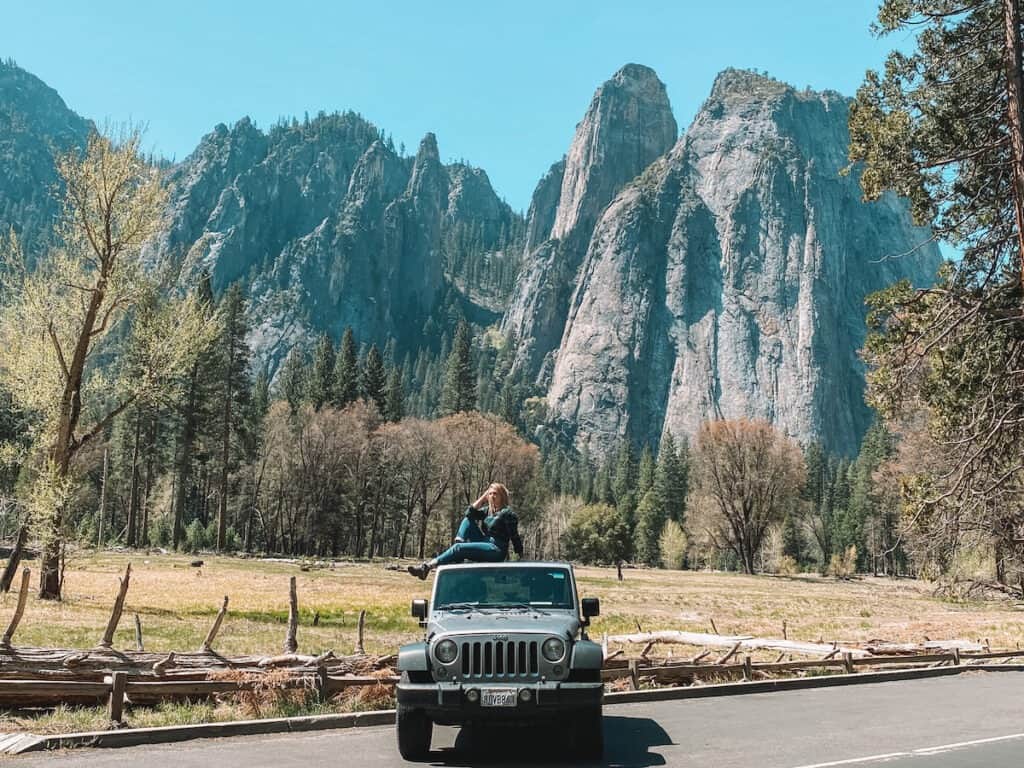
A trip to Yosemite is a must-do for every person who loves hiking, waterfalls, or just being in really ridiculously beautiful places. I’ve visited Yosemite National Park over 10 times, and it takes my breath away every visit.
This comprehensive guide covers everything you need to know about the closest airports to Yosemite National Park. It also includes everything you need to know about how to get to Yosemite National Park.
The closest airports to Yosemite National Park are Fresno-Yosemite International Airport and Mammoth Yosemite Airport, but the best major airports I recommend when flying to Yosemite are San Francisco, Oakland, and Sacramento International Airports.
This guide covers each of these airports in-depth below, as well as additional tips on how to get to Yosemite and more options for the closest airport to Yosemite.
Disclosure: This page may contain sponsored content or affiliate links, including Amazon links, where I earn a small commission from any purchase – at no extra cost to you. This commission helps keep Brooke In Boots up and running. As always, all opinions are 100% honest and my own!
Closest Airports to Yosemite National Park
The closest major airports to Yosemite are Oakland, San Francisco, and Sacramento International Airports. In my experience, flying into San Francisco and Oakland are usually the cheapest airports for flying to Yosemite. But, you have to deal with Bay Area traffic which can add literally HOURS to your drive.
The Sacramento Airport is small and easy to navigate making it my personal favorite major airport near Yosemite.
The best mid-sized airport to Yosemite National Park is the Fresno-Yosemite International Airport. Fresno is a mid-sized airport located less than 3 hours from Yosemite Valley, making it easy drive to Yosemite National Park.
Most visitors to Yosemite will fly into one of the following airports:
| Airport | Park Entrance | Distance to Yosemite Valley |
|---|---|---|
| Fresno-Yosemite International Airport (FAT) | Wawona Entrance | 2 Hours 30 Min / 95 Miles |
| Mammoth Yosemite Airport (MMH) | Tioga Pass / East Entrance (Closed in Winter) | 2 Hours 30 Min / 105 Miles |
| Oakland International Airport (OAK) | Big Oak Flat Entrance | 3 Hours 45 Min / 175 Miles |
| Sacramento International Airport (SMF) | Big Oak Flat Entrance | 3 Hours 45 Minutes / 180 Miles |
| San Francisco International Airport (SFO) | Big Oak Flat Entrance | 4 Hours / 200 Miles |
| San Jose Airport (SJC) | El Portal / Highway 140 | 4 Hours / 200 Miles |
| Reno-Tahoe International Airport (Nevada) (RNO) | Tioga Pass / East Entrance (Closed in Winter) | 4 Hours 30 Minutes / 210 Miles |
Each of these closest airports to Yosemite is covered more in-depth, below.
Map of the Closest Airports to Yosemite National Park
Yosemite is located deep in the heart of one of the most stunning mountain wildernesses in North America. But unfortunately, that means that flying to Yosemite is pretty difficult.
The closest major airports to Yosemite National Park are still several hours from the Park entrances.
There are also a number of very small regional airports near Yosemite, including Merced Regional Airport and Stockton Regional Airport. These airports are served mostly used by private airplanes and luxury charter services, so I haven’t included them here.

Fresno-Yosemite International Airport (FAT)
Distance: 95 miles to Yosemite Valley
The Fresno-Yosemite International Airport (FAT) [an unfortunate airport code, I know] is the closest mid-sized airport to Yosemite, and for most visitors the best airport for traveling directly to Yosemite, Kings Canyon, and Sequoia National Parks.
If you’re visiting all three Sierra Nevada parks (and you should!), Fresno-Yosemite is the most convenient spot to fly into. FAT is about 2 hours from Sequoia and 1 hour from Kings Canyon National Parks.
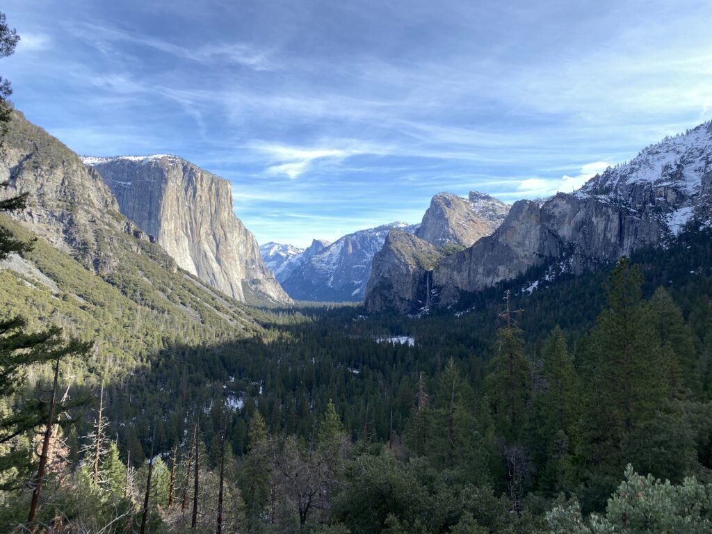
Driving from Fresno to Yosemite Valley takes 2.5 hours. Highway 41 winds from the Sierra foothills, climbing to 6,000′ at the Yosemite South (Wawona) Entrance. From Wawona, it’s another hour into Yosemite Valley, where you’ll be rewarded with the iconic Wawona Tunnel view—a must-see on any Yosemite itinerary!
For groceries, hotels or last-minute camping supplies, Oakhurst, an hour from the park on this route, is the perfect stop, and one of my favorite places to stay outside Yosemite National Park.
>> Click here to book flights to Fresno-Yosemite Airport
San Francisco International Airport (SFO)
Distance: 200 Miles / 4 Hours
San Francisco International Airport is one of the most popular airports for flying to Yosemite. Flying into SFO makes it easy to also visit San Francisco – one of my favorite spots in my home state!
Take a street car to Fisherman’s Wharf, get excellent dim sum in Chinatown, stroll through Golden Gate Park, or visit the infamous Alcatraz.
To get to Yosemite from San Francisco, you’ll have to cross one of the many bridges that span San Francisco Bay. All of these bridges have tolls, usually around $7 to $9. You’ll drive east via California State Route 120. If you need to pick up groceries, the best place to stop before Yosemite is the small town of Oakdale.
The Big Oak Flat Entrance or West Entrance enters Yosemite National Park through Highway 120 from the town of Groveland, California.
If you are driving from the Bay Area, the Big Oak Flat Entrance is the most direct entrance to the Park.
However, this steep and winding road isn’t the best to use in winter. To avoid icy conditions, you might want to use the El Portal / Highway 140 Entrance. The El Portal Entrance doesn’t gain or loose as much elevation as the other Park entrances, making it a relatively straightforward trip, and often less icy and treacherous in winter.
>> Click here to book flights to San Francisco International Airport

Oakland International Airport (OAK)
Distance: 175 Miles / 3 Hours 45 Minutes
Oakland International Airport is one of the closest major airports to Yosemite National Park. OAK is located just outside the city of San Francisco, in the city of Oakland.
One of the advantages of flying into Oakland instead of San Francisco is that you avoid having to drive through the city of San Francisco itself , although you will still experience a TON of traffic during rush hour here.
Another bonus of flying into OAK instead of SFO is that you avoid some toll roads and bridges on the way to Yosemite.
Oakland International Airport, is approximately 3 Hours and 45 Minutes to Yosemite Valley via the Big Oak Flat Entrance.
>> Click here to book flights to Oakland International Airport
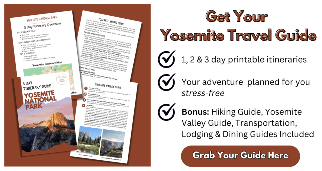
Take this itinerary to go! The printable Yosemite Itinerary Guide has your perfect 1, 2, or 3 day Yosemite trip completely planned for you! With over 20 pages of detailed hiking guides, printable daily itineraries, lodging and dining suggestions and more, you can spend less time planning and more time making epic memories! Check it out, here.
San Jose Mineta International Airport (SJC)
Distance: 200 Miles /4 Hours
San Jose is located just south of San Francisco, still in the Bay Area. Its a major regional airport, but not nearly as large as San Francisco or Oakland. You’ll still hit some Bay Area traffic, but less than SFO and OAK.
If you fly into San Jose Airport, don’t forget to spend the day checking out Pinnacles National Park just outside San Jose.
Before entering the Park on Highway 140, you will pass through the town of Mariposa, approximately 1 Hour from Yosemite Valley. Mariposa is a small town with a grocery store, restaurants, and lodging and conveniently located for visitors not staying inside the Park.
>> Click here to book flights to San Jose

Sacramento International Airport (SMF)
Distance: 180 Miles / 3 Hours 45 Minutes
The Sacramento International Airport is another of the closest major airports Yosemite National Park. The airport is located in the California state capitol of Sacramento, a city of about 500,000.
Sacramento is a great alternative airport to SFO and Oakland, especially if you are planning on driving directly to Yosemite Valley, and want to avoid Bay Area traffic headaches.
>> Click here to book flights to Sacramento International Airport
Reno Tahoe International Airport (RNO)
Distance: 210 Miles / 4 Hours 30 Minutes
Finally, Reno-Tahoe International Airport is personally my favorite one to fly into during the summer and fall season! Don’t try flying here while Tioga Road is closed! There are no entrances to Yosemite on the eastern side of the Sierras during winter and spring.
If you are visiting Yosemite during summer to late-Fall, I highly recommend driving through the Tioga Road entrance at least once – it’s truly spectacular!
Tioga Road winds from through the magnificent high Sierras to Yosemite’s East Entrance and into Yosemite Valley.
Located just across the state line in Reno, Nevada, the Reno-Tahoe Airport is a small but comfortable airport. The Reno-Tahoe Airport has easy access to Lake Tahoe, the Northern and Eastern Sierras, as well as Yosemite via the Tioga Road Entrance.
To get from Reno to Yosemite Valley, you’ll drive south on Highway 395 to the town of Lee Vining. Along the way, stop at iconic sights like Lake Tahoe, Mono Lake, and the numerous hot springs that dot this area.
From Lee Vining, it is a short, but extremely steep, 20 minutes to the Park Entrance and over Tioga Road. The road climbs to Tioga Pass, at nearly 10,000 feet in elevation. The road passes through Tuolumne Meadows, Tenaya Lake, Olmstead Point, and dozens of the most spectacular hiking trails in the world.
It takes approximately 2 hours to drive from the Park’s East Entrance station to Yosemite Valley.
>> Click here to book flights to Reno-Tahoe International Airport
The Closest Regional Airports to Yosemite National Park
Mammoth Yosemite Airport (MMO)
Distance: 105 Miles to Yosemite Valley
The Mammoth Yosemite Airport is a small regional airport in the town of Mammoth Lakes. Mammoth a popular ski and mountain destination in the Eastern Sierras.
Mammoth Yosemite Airport is serviced by “semi-private” charter flights from Southern California.
The lack of regular commercial flights means that Mammoth-Yosemite isn’t a popular option for flying into Yosemite for most visitors. Learn more about flying into Mammoth-Yosemite Airport, here.
>> Click here to book flights to Mammoth Yosemite Airport
Take this itinerary to go! The printable Yosemite Itinerary Guide has your perfect 1, 2, or 3 day Yosemite trip completely planned for you! With over 20 pages of detailed hiking guides, printable daily itineraries, lodging and dining suggestions and more, you can spend less time planning and more time making epic memories! Check it out, here.
Tips for Getting from the Airport to Yosemite National Park
IMPORTANT YOSEMITE UPDATE: Yosemite National Park now requires day-use and peak-hours reservations to enter Yosemite for dates in February & April – October. Learn more about these new changes, here.
After booking the best airport for Yosemite National Park, you’ll need to figure out to get from the airport to Yosemite National Park itself. I’ve driven to Yosemite dozens of times from all over California, and these are some important tips I’ve learned.
An important thing to remember is Yosemite is huge – about 748,000 acres, or about the size of the state of Rhode Island!
Most visitors will drive from the airport to Yosemite, and having a vehicle while visiting the Park is highly recommended. Why?
Well, like I said, Yosemite is huge, and only some of it is accessible through paid or free shuttles. In my experience, for maximum flexibility and to really experience Yosemite, you’ll want to have your own transportation.
Do NOT rely on cell service for driving directions to Yosemite. Cell service is unreliable and nonexistent in most areas of the park. Always print or write out your Yosemite itinerary or download it to your phone before leaving.
When planning your drive to Yosemite, double check that your directions are taking you to your specific destination within the Park. Yosemite is massive, with multiple entrance stations, and typing in just “Yosemite” to your GPS or map app will NOT get you where you want to go!
When visiting during peak months of late Spring to early Fall, expect long wait times at entrance stations, and full parking lots at popular destinations. The key to a stress-free (or at least less-stress) Yosemite itinerary is to exercise patience and kindness, especially during peak hours.
Visiting during winter and spring? Tioga Road is closed seasonally in the winter, usually from late-November to May (or later in high-snow years). Other roads throughout the park may close during severe weather.
Chains may be required during winter and spring. Tire chain requirements are strictly enforced and you will not be allowed to drive on roads if you do not have the required equipment.
More Yosemite Resources to Plan Your Next Trip
17 Amazing Easy & Short Hikes in Yosemite National Park
13 Iconic Yosemite Waterfalls & Waterfall Hikes in Yosemite National Park
Where to Stay in Yosemite: Best Hotels & Lodging for Every Budget
Yosemite Reservations and Permits 2024: Everything You Need to Know
Best Entrance to Yosemite National Park & Tips for Driving to Yosemite
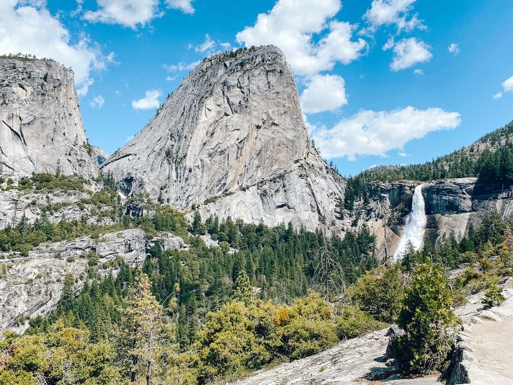
Hiking the Mist Trail to Vernal and Nevada Falls in Yosemite
Want to learn more about planning an epic National Parks trip? Grab my free Ultimate National Parks Planning Guide, including 70+ pages of National Park packing checklists, planning tips, and everything you need to know to start planning a trip to all 63 National Parks!

