Ready to explore Big Bend National Park? Big Bend is a hiker’s dream, with unforgettable trails and plenty of adventure for hikers of all abilities.
From challenging Chisos Mountains hikes like Lost Mine Trail and Emory Peak, to family-friendly river hikes like Santa Elena Canyon, Big Bend has a wide variety of trails for every level.
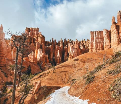
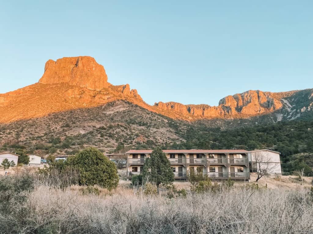
I first visited Big Bend in 2022, and the soaring cliffs, deep river canyons, rugged mountains, and vast desert trails capture what makes Big Bend so special, and one of my favorite National Parks.
This in-depth guide includes 16 of the top hikes in Big Bend National Park. I’ve also included important hiking tips, maps, and reasons why each hike deserves a spot on your bucket list, it’s your go-to resource for planning your next adventure in Big Bend National Park.
Disclosure: This page may contain affiliate links where I earn a small commission from any purchase – at no extra cost to you. This commission helps keep Brooke In Boots up and running. As always, all opinions are 100% honest and my own!
These hikes are broken down below by difficulty level: Easy, Moderate, and Strenuous.
Want to learn more about visiting Big Bend National Park? Check out my Epic Big Bend Itinerary Guide for suggestions on planning the perfect Big Bend trip, where to stay, and how to spend 1, 2 or 3+ days inside one of my favorite National Parks.
A Quick Look at the Best Hikes in Big Bend National Park
Best Easy Hike in Big Bend: Santa Elena Canyon
Best Moderate Hike in Big Bend: Lost Mine Trail
Best Strenuous Hike in Big Bend: South Rim Trail
Best Hike for Families in Big Bend: Santa Elena Canyon
Map of the Best Hikes Big Bend National Park
Big Bend National Park is huge. It can take over an hour to drive from one end of the Park to the next. Carefully planning your Big Bend itinerary makes sure that you don’t waste unnecessary time driving, as well as ensuring that you actually get to see everything you want to in this incredible Park.
Use this map to find the best hikes in Big Bend National Park and start planning your Big Bend trip.
How to Use This Map: Click the Icons on the map to see more information about each location. Click the star at the top of the map to add the map to your Google Maps account.

Important Tips for Hiking in Big Bend National Park
Planning a hike in Big Bend? Before hitting the trails, review these important tips for hiking in Big Bend National Park:
- BRING WATER. This is a desert park and hikes are dry and hot, even in the winter. Bring more water than you need – at least 1 Liter for every hour of hiking. Learn more about how to prepare for a day hike here.
- Arrive in the Park as early as possible, ideally before 7AM to make the most out of your day, and avoid the heat and crowds. Learn more about the weather in Big Bend, here, and plan for the weather.
- Parking is limited at trailheads – especially in the Chisos Mountains. Arrive early and be prepared to park some distance from the trailhead and road-walk if necessary.
- Carry an extra supply of water and emergency essentials – like emergency blankets and snacks in your vehicle. Learn more about packing for your Big Bend National Park trip (and download a free National Parks packing checklist!) here.
- Download a map before you hit the park – there’s basically no cell service inside Big Bend, outside the Lodge or Visitor Centers. Download your maps and GPS files before you enter the park!
Need a map? Don’t forget to download your map and save it to your phone or GPS device before your hike! Get AllTrails Plus or AllTrails Peak (the most used trail app on my phone!) to download all your trail maps for offline use. Use my promo code brookeinboots30 to get 30% off your annual AllTrails subscription!
Always remember to practice Leave No Trace, stay on designated trails, and respect historic and native sites. Big Bend is the ancestral home of the Chiso and Jumanos.

Is Big Bend Hiking Safe?
I personally never felt unsafe while visiting Big Bend, or across the border in Boquillas del Carmen, Mexico.
But like all National Parks, it’s important to be mindful of the natural hazards present in the desert environment. The park is home to diverse wildlife, including bears, mountain lions, and venomous reptiles, so it’s essential to follow safety guidelines and be vigilant when hiking or camping!
Additionally, visitors should be prepared for the remote and rugged terrain, and always carry sufficient water and emergency essentials while exploring the park.
I personally always carry a Personal Locator Beacon / Satellite communicator when visiting a National Park like my Garmin InReach Mini 2 (monthly subscription required). With this device I can send text messages, track my hike, view offline maps, or hit the SOS button to contact search and rescue in a true emergency.
Finally, Big Bend is located on the United States border with Mexico. Despite what you see on the news, Big Bend is not overrun with drug traffickers, human smugglers, and bandits. Like San Diego or El Paso, it is a relatively safe area with some unique issues.

Although rare, illegal crossings and drug smuggling does occur from time to time. If you see anything that looks suspicious, keep away, note the location, and call 911 or alert NPS and CBP staff when possible. Learn more about visiting a border area, here.
If you see people in distress, especially anyone injured or asking for water, immediately contact authorities. Lack of water is a life-threatening emergency in the desert.
Bear Safety in Big Bend National Park
Are there bears in the middle of the desert? Yes! Black Bears and Mountain Lions are active in Big Bend. Bear encounters are common, especially in the Chisos Mountains. Stay safe by remembering a couple of things:
- Give bears plenty of space.
- Talk and make noise while hiking to avoid surprising a bear.
- Always store your food properly and never ever feed wildlife.
- If you see a bear, back away slowly. NEVER run from a bear.
Learn more about bear safety in Big Bend National Park, here.

Big Bend National Park Guides & Resources
3 Day Big Bend Itinerary Guide
14 Epic Things to Do in Big Bend National Park
Hiking Big Bend: 16 Can’t-Miss Hikes in Big Bend National Park
Driving Ross Maxwell Scenic Drive in Big Bend National Park
Best Lodging Near Big Bend National Park
How to Visit Boquillas Del Carmen Mexico from Big Bend National Park
Best Easy Hikes in Big Bend National Park
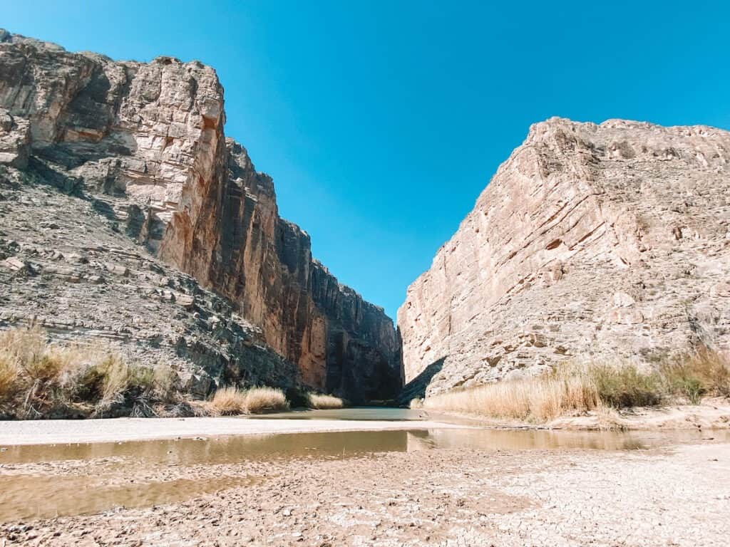
Santa Elena Canyon Trail
- Distance: 1.7 Miles
- Elevation Gain: 215 Feet
- AllTrails Trail Map
Santa Elena Canyon is one of the most famous and instantly recognizable hikes in Big Bend National Park, and one of my favorite things we did in Big Bend we did during our trip!
This short but sweet trail is one of the best Big Bend trails for families, and definitely belongs on every Big Bend itinerary. The trail begins at the end of Ross Maxwell Scenic Drive, a paved road accessible to all vehicles.
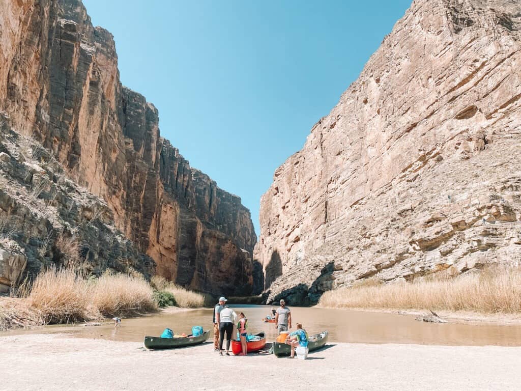
The trail follows a short dirt and boardwalk path that leads from the large parking area to the mouth of Santa Elena Canyon. Here, the Rio Grande River carved an 8 mile long and 1,500 feet deep massive canyon through the rock. This spot is popular for photographers and boaters embarking on trips down the river.
After crossing Terlingua creek, a short series of stone switchbacks ascend part-way up the canyon before gradually descending to the water’s edge. The trail follows the shady river’s edge, until the canyon walls meet the water.
When water levels are low, adventurous hikers continue upriver from here, using the river as a trail. Be very careful as river currents can be deceptively strong, and swimming here is not permitted. At the very least, bring a pair of water-sandals and dip your toes into this iconic river the defines the park.
This trail may close periodically during periods of rain, flash floods, and high-water. Do not attempt to cross the creek when the trail is closed, or attempt to cross anywhere other than the designated trail.

Chisos Basin Loop Trail
- Distance: 1.8 Miles
- Elevation Gain: 450 Feet
- AllTrails Trail Map
This easy trail begins behind the Chisos Basin visitor center and winds through the Mountain juniper forests with views of the surrounding Chisos Mountains. The hike is perfect if you’re short on time or looking for an easier trail in the magnificent Chisos Basin.
If you plan on hiking the more strenuous trails to South Rim, Laguna Meadows or Emory Peak, those hikes also leave from the same trailhead.
Hot Springs Historic Trail
- Distance: 1 Mile
- Elevation Gain: 150 Feet
- AllTrails Trail Map
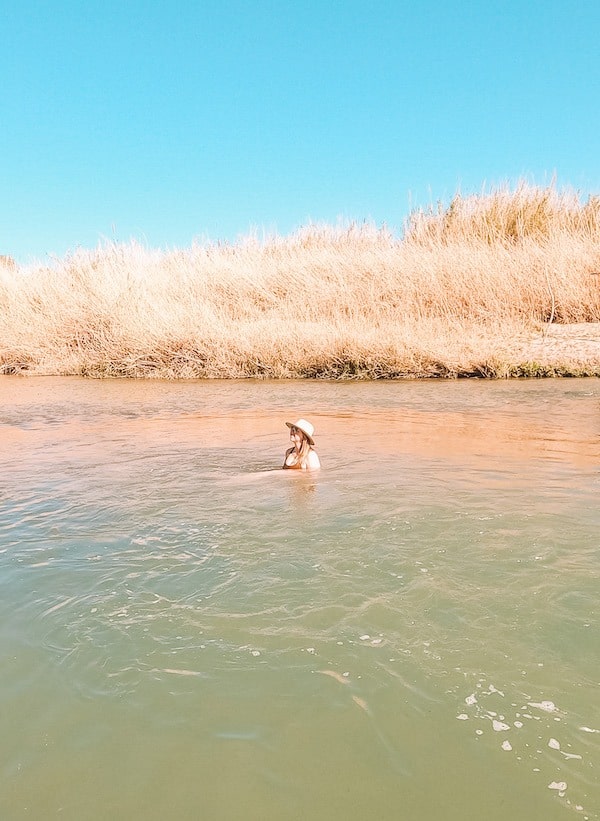
Less of a hike and more of a sandy walk, this short trail leads to an active hot spring and the remains of the historic bathhouses and cabins that once existed along the Rio Grande.
While the bathhouses are now ruins, visitors can wade into a natural hot spring built right into the side of the Rio. Bring a bathing suit, swim sandals, and a quick drying towel.
You might also need to bring and an open mind, rangers warned us when we visited that most people find this to be a “clothing optional” hot spring once the sun sets.
If you plan on enjoying the hot springs along this trail, make sure to check the NPS website for updates – the hot spring closes during flooding and increased bacteria levels. Never submerge your head in a hot spring and never drink the hot spring water! Remember that crossing the Rio into Mexico is illegal here.

Lower Burro Mesa Pouroff Trail
- Distance: 1 Mile
- Elevation Gain: 125 Feet
- AllTrails Trail Map
The Lower Burro Mesa Pouroff Trail is a short trail twists between the volcanic hills and canyons that define the desert area of the Park. This trail is a great introduction to the desert areas of the Park.
If visiting in late spring through fall, try hiking first thing in the morning and bring plenty of water. Summer temperatures can be very dangerous here!
The trail dead ends in a small canyon “pouroff” – a canyon wall that is dry most of the year but becomes a roaring waterfall during summer storms.
Avoid this area during heavy rain as flash floods are possible.

Tuff Canyon Trail
- Distance: 1 Mile
- Elevation Gain: 200 Feet
- AllTrails Trail Map
Explore the small but strange Tuff Canyon on this 1 mile out and back trail. The canyon is made of “Tuff” a white volcanic ash rock that lends the canyon its unusual color and name.
The trail follows the rim of the canyon along 3 viewing platforms, or descend into the canyon by following the trail at the south end of the parking lot. Follow the drainage upstream into the Canyon and return via the same route.
Window View Trail
- Distance: 0.4 Miles
- Elevation Gain: 0 Feet
- AllTrails Trail Map
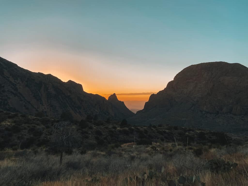
This short, paved trail has sweeping views of The Windows rock formation and surrounding Chisos Mountains. The trail leaves from the Chisos Basin trailhead, located directly behind the Chisos Lodge and parking lot.
I found the Window View trail to be a particularly beautiful spot for sunset. In my experience, make sure to arrive 15 to 20 minutes before sunset to get a good spot on this short trail. Afterwards, head to the Chisos Mountain Lodge bar for a “Ranch Water” the go-to cocktail in West Texas.
This trail is wheelchair accessible.

Rio Grande Nature Trail
- Distance: 1 Mile
- Elevation Gain: 200 Feet
- AllTrails Trail Map
You might be surprised that this desert park is home to lush river marshes and excellent bird-watching. The Rio Grande Village Nature Trail departs from the Rio Grande Village Campground. The trail follows a boardwalk over the river marshes where birds are plentiful, especially at sunrise.
The trail ascends a small ridge with panoramic views of the river valley and far off Chisos Mountains. The views are particularly colorful at sunset!
Planning a trip to Big Bend National Park? The Big Bend Itinerary Guide has your perfect 1, 2, or 3 day Big Bend trip completely planned for you! With over 20 pages of detailed hiking guides, printable daily itineraries, lodging and dining suggestions and more, you can spend less time stressing and more time making epic memories! Check it out, here.

Boquillas Canyon Trail
- Distance: 1.5 Miles
- Elevation Gain: 200 Feet
- AllTrails Trail Map
This easy out and back trail follows the Rio Grande through another one of Big Bend’s limestone canyons.
If you’re looking to avoid crowds, this hike is less well-known than Santa Elena Canyon trail.
The trail is mostly flat with short but steep hills at the beginning and end of the trail. As with all trails along the Rio, remember that crossing the river into Mexico is illegal, except at the nearby official Boquillas Border Crossing station, managed by US Customs and Border Patrol. Learn more about visiting Boquillas, Mexico, in my Big Bend Itinerary guide, here.

Ernst Tinaja Trail
- Distance: 1.1 Mile
- Elevation Gain: 100 Feet
- AllTrails Trail Map
This short and easy hike has a big payoff for relatively little effort, making it one of the coolest hikes in Big Bend. The Ernst Tinaja trail follows a small slot canyon to a series of deep pools called tinajas (pronounced “tin-ah-has”).
Just getting to this trail is an adventure itself. The trailhead is located on Old Ore Road, one of the many primitive roads throughout the Park. A high-clearance 4×4 vehicle is recommended to drive Old Ore Road.

Balanced Rock via Grapevine Hills Trail
- Distance: 2.2 Miles
- Elevation Gain: 250 Feet
- AllTrails Trail Map
The unique Balanced Rock is the highlight of this easy-to-moderate desert trail.
Getting to the trailhead itself is half the challenge, however. The 6-mile gravel road to this trailhead, Grapevine Hills Road, requires a sturdy, high-clearance vehicle, and possible four-wheel drive. Do not attempt this road in a sedan, minivan, or oversized vehicle.
This is an easy hike that involves some moderate-level scrambling at the end to reach the rock formation. The trail is popular with kids and adults alike, but make sure to follow the directional arrows on the rocks, wear proper footwear with good traction, and especially take care while descending.
Best Moderate Hikes in Big Bend National Park
Lost Mine Trail
- Distance: 4.8 Miles
- Elevation Gain: 1,200 Feet
- AllTrails Trail Map
If you only have time to do one hike while visiting Big Bend, I highly recommend the Lost Mine Trail. The views of the Chisos Mountains and surrounding desert are breathtaking.
This was easily our favorite day hike when we visited Big Bend. It’s the perfect combination of mountain forests, a rewarding climb, and simply incredible views of the desert in every direction.
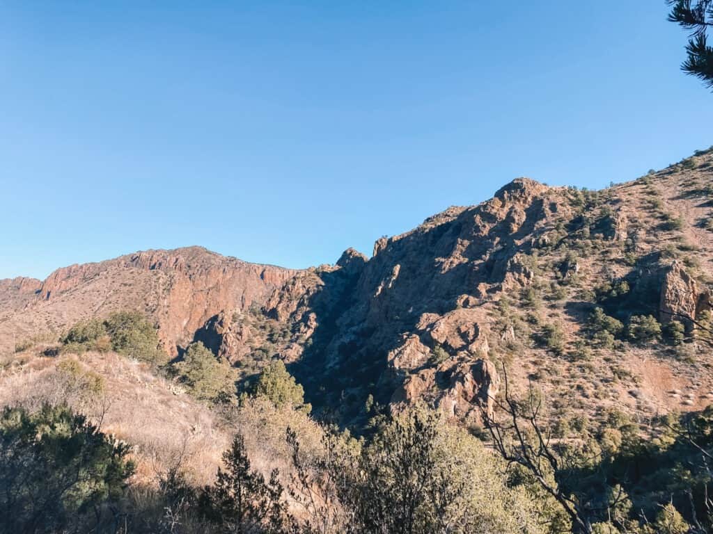
This moderately difficult trail ascends steeply through the Chisos Mountains through forests of oak and juniper pines to stunning views of the Chisos Basin, Juniper Canyon and surrounding mountains.
The higher elevation within the mountains means that the trail stays a lower temperature than the desert areas of the park, although be sure to bring plenty of water and sun protection. The small parking lot fills quickly for this trail. Plan to arrive before 7:30 AM during the busy season.

Window Trail
- Distance: 5.6 Miles
- Elevation Gain: 950 Feet
- AllTrails Trail Map
The trail descends into Oak Creek Canyon before arriving at the “Window”, a dry creek bed and rock formation that overlooks the vast desert of Big Bend below. Don’t be fooled by the hike down, the return trip is all uphill!
This is a popular trail that leaves from just behind the Chisos Basin Visitor Center and Lodge, where there is ample parking. However, if you’re deciding between The Window and Lost Mine Trail, I would recommend the Lost Mine Trail for more outstanding views.
The trail involves some moderate scrambling for the last 0.25 Miles to reach the Window. Sturdy shoes and plenty of water a must here!

Chimneys Trail
- Distance: 4.8 Miles Round Trip (7.5 Miles Point to Point)
- Elevation Gain: 400 Feet
- AllTrails Trail Map
The Chimneys Trail trail captures the essence of Big Bend’s vast desert.
Take in wide vistas, desert plants, volcanic rock formations, and even Native American petroglyphs etched high on the “Chimneys” – a volcanic rock formation.
Most hikers turn around after the Chimneys, but you can actually continue all the way to the unpaved Old Maverick Road. If you have two cars or can arrange a ride, consider hiking the 7.5 Miles (one way) as a point-to-point hike.
There is little to no shade on this desert hike. Plan to arrive early when temps are low, and bring plenty of water.
Mule Ear Spring Trail
- Distance: 3.8 Miles
- Elevation Gain: 880 Feet
- AllTrails Trail Map
Starting at the Mule Ears Overlook along Maxwell Scenic Drive, this moderate desert hike winds through the unforgiving Chihuahuan desert. In the distance, catch a glimpse of the “Mule Ears” – unique volcanic spires shaped exactly like, you guess it, mule’s ears.
The hike ends at a historic corral and spring that was once a vital resource for ranchers in this area.
This hike has little to no shade. Hike early in the morning and avoid entirely if visiting during the summer.
Want to learn more about planning an epic National Parks trip? Grab my free Ultimate National Parks Planning Guide, including 70+ pages of National Park packing checklists, planning tips, and everything you need to know to start planning a trip to all 63 National Parks!
Best Strenuous Hikes in Big Bend National Park

Emory Peak
- Distance: 10.5 Miles
- Elevation Gain: 2,500 feet
- AllTrails Trail Map
Hike to the highest peak in Big Bend National Park, Emory Peak. This long and strenuous hike is a serious undertaking at over 10 miles, making it one of the most difficult, but worth-it day hikes in Big Bend.
The first half of the trail is mostly shaded under trees, and the trail passes multiple primitive and backcountry campsites for those who want to make it a multi-day trek. Bears are frequently seen in this area, as well as the occasional mountain lion, so stay alert and consider carrying bear spray.
Hikers have the option of dropping heavy bags in the designated bear boxes at the Toll Mountain primitive campground, about 2 miles from the summit.
The trail ends with an option 25 foot scramble with some exposure risk (about 5 minutes of climbing) to reach the proper summit. Careful footing is required, a fall in certain areas could lead to serious injury or death.
The scramble is not well marked, (sources say stick to the right) but choose your route and footing carefully and you will be fine. Hikers with a fear of heights or who are uneasy with scrambles should avoid this section, but will still find the hike worth the effort!
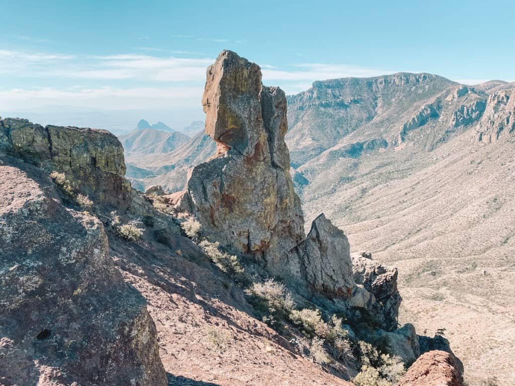
South Rim Loop via Emory Peak and Boot Springs Trail
- Distance: 12 Miles (15 Miles with Emory Peak)
- Elevation Gain: 3,200 Feet (including Emory Peak)
- AllTrails Trail Map
The grand-daddy of hikes in Big Bend, the South Rim Loop has it all: mountain summits, harsh deserts, shady canyons, and unbeatable views of the South Rim of Chisos Basin.
This loop combines the steep Pinnacles Trail, Emory Peak, Boot Springs and South Rim and Laguna Meadows Trail into a massive 15 Mile Loop (12 Miles if you skip the spur trail to Emory Peak) that is NOT for the faint of heart.
Want to spend the night exploring one of the prettiest parts of Big Bend National Park? There are numerous backcountry primitive campground sites along the trail, making it a popular backpacking loop.
Fit and speedy day hikers can finish the loop in 8 – 10 hours.
As with all desert hikes, water is not available along the trail here, so plan to bring plenty to sustain you over the nearly 3,200 feet of elevation gain.
Bears are frequently seen in this area, as well as the occasional mountain lion, so stay alert and consider carrying bear spray.
If you’re looking for the ultimate challenge and ultimate views, this is truly the best hike in Big Bend National Park.
Big Bend National Park Guides & Resources
3 Day Big Bend Itinerary Guide
14 Epic Things to Do in Big Bend National Park
Hiking Big Bend: 16 Can’t-Miss Hikes in Big Bend National Park
Driving Ross Maxwell Scenic Drive in Big Bend National Park
Best Lodging Near Big Bend National Park
How to Visit Boquillas Del Carmen Mexico from Big Bend National Park
Planning a trip to Big Bend National Park? The Big Bend Itinerary Guide has your perfect 1, 2, or 3 day Big Bend trip completely planned for you! With over 20 pages of detailed hiking guides, printable daily itineraries, lodging and dining suggestions and more, you can spend less time stressing and more time making epic memories! Check it out, here.